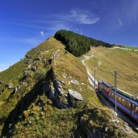
Lake Garda
we prepare the page
Lake Garda, neboli jezero také nazývané Lago di Benaco, se rozkládá mezi Alpami a pádskou nížinou v provinciích Alto Adige, Lombardií a Venetem na rozloze 365 km čt. Vodní plocha je utvořena z Etschekého ledovce po poslední době ledové. Lago di Garda je největší italské jezero. Length Lake činí 51,8 km a šířka 17,4 km, průměrná hloubka jezera se udává 136 m a místy dosahuje až 360 m. Délka gardských břehů je více jak 157 km. Lake Garda leží v nadmořské výšce pouhých 65 meters.
Zájezdy na Lago di Garda
Kouzlo jezera objevili již staří Římané, kteří ho nazvali Benaco. Města kolem jezera se ve středověku stala sídly veronských, milánských a benátských šlechticů. In 19. století se začíná turismus rozvíjet,zéjména v důsledku budování silnic okolo jezera. Dnes je oblíbeným místem turistů, cykloturistů, windsurfařů a v neposlední řadě také horolezců , protože je zde řada nádherných ferrat-zajištěných cest. Lago di garda láká svou polohou a rozmanitostí k návštěvě a je zde mnoho levného accommodation v hotelích, penzionech či apartmánech.
Již dob římanů se v okolí pěstuje vinná réva, především okolo jižníh břehů. Také olivy a citrusy, hlavně na západní straně. Na březích jezera leží mnoho historických měst, mezi něž patří například Sirmione, Desenzano, Salò, Gargnano, Riva, Malcesine, Torri del Benaco, Garda, Bardolina a Peschiera.
Zajímavosti Gardského jezera
Dochází k jevu, že při náhlém poklesu tlaku vzduchu se na krátkou dobu zvýší hladina jezera průměrně o 30 cm.
Na jezeře bývají viditelné proudy vody, jako řeky. Dochází k tomu v důsledku nerovnováhy teplot vody.
Lago di Garda má 25 přítoků, hlavním z nich je řeka Sarca. Výtok je pouze jeden a to řeka Mincio (Někdy se bere Sarca a Mincio jako jedna řeka).
V jezeře je pět malých ostrovů.
Zajištěné cesty neboli via ferrata na Lago di Garda jsou trochu jiného charakteru něž, na jaký jsou ferratisté zvyklí třeba z Dolomit nebo Julských Alp. Je to způsobeno zejména zcela odlišnými klimatickými podmínkami. V těchto oblastech se setkáme se zajištěnými cestami táhnoucími se po holých skalách bez kousku trávy a či stromů. V okolí Gardy jsou ferraty které na první pohled připomínají spíše pochod lesní krajinou s jištěním na lanech. Typické jsou pak přechody mezi jednotlivými zajištěnými úseky, po stezkách. Ferrata tak není zcela plynulá. Nic to však neubírá na jejich impozantnosti nebo náročnosti. Co se náročnosti týče můžete vyzkoušet krátké nenáročné ferraty, které zvládnou i děti nebo naopak vysoce fyzicky i horolezecký náročné cesty. Ve vybavení každého ferratisty nesmí chybět sedací úvazek, ferratový set, odsedka s karabinou, pevná obuv, helma, případně rukavice, čelovka, kratší lano a slaňovací osma. Některé cesty vedou starými vojenskými oběkty, kavernami a tunely, čelovka se tedy někdy stává nezbytností, běžné jsou i křižovatky v tunelech. Detailní popisy jednotlivých zajištěných cest připravuji, vřele však doporučujeme zakoupit průvodce ferratami Klettersteigführer od nakladatelství Alpinverlag.
Via Ferraty Lago di Garda
| Name | Obtížnost (A-E) | Čas (h) |
| Via ferrata Rino Pisseta | It | 5 |
| Via ferrata Ernesto Che Guevara | C | 7,5 |
| Via ferrata Giulio Segata | D/E | 4,5 |
| Via Ferrata Rio Salagoni | C | 2 |
| Sentiero attrezzati Colodri | B/C | 3 |
| Sentiero Scaloni | A | 3,5 |
| Via dell´ Amicizia | B/C | 6 |
| Via ferrata Susati | B | 5,5 |
| Via ferrata Foletti | B | 6 |
| Sent. dei Camminamenti | A/B | 5,5 |
| Sent. delle Laste | A/B | 5 |
| Via attrezzata Monte Albano | D | 3,5 |
| Via ferrata Gerardo Sega | B/C | 6 |
| Ferrata della Spigolo Bandiera | C/D | 4 |
| Ferrata E. Franco | D | 4 |

Croatia
preparing a site
Croatia,
Máme pro Vás báječné typy na ubytování v Chorvatsku, Apartments by the sea.
Ubytování v apartmánech, hotelích a pensionech na málo známých a malých Chorvatských ostrovech nebo majácích, kde najdete klid a pohodu bez velkých davů turistů na ´´soukromé´´ pláži, krásnou přírodu a čisté moře.
Navíc zde na Vás čeká chutná gastronomie, dobré víno a milí lidé.
Ostrov Lastovo
Non Valley
Non Valley
 Trentino: Valle di Non
Area VALLE DI NON sousedí po celé své hranici s bývalým Jižním Tyrolskem. Jde or poměrně nízce položenou oblast in Široké údolí, které NEMA
zadné významnější Centre. Je však velmi úrodné to jeho plochy pokrývají rozsáhlé sady. Teto oblasti if TaKé Rika Jablková zahrada.
Horské skupiny: Přestože je velmi údolí ploché, jeho jihozápadním na boku začíná oblast Brenty. Některé návštěvníky Muze potěšit the
nenápadná východní skupina plateau of Predaia začínající u sedla Mendel. Někdy if nazývá Nonsberg.
STŘEDISKA: Cavareno, Cles, Coredo, Bottom, Rumo, Sanzeno, Tuenbo
CO NAVŠTÍVIT: Hory Bezesporu Brenty. Nástupů je nausea, ten copies nejlepší je u městečka Tueno, odkud Vedas horská Tóvel ve jezeru silnice by AZ
výšce 1178 meters. Zajímavá je i jezerní oblast methane Lago di S. Giustina.
Zájezdy do Itálie on-line

South Tyrol – South Tyrol – South Tyrol
South Tyrol – South Tyrol – South Tyrol
 Trentino- je kraj, whose pristine nature offers many sports activities. Determine the character of the local valley lakes, rivers and streams, but also forests, vineyards and alpine meadows with flowers and flying birds and butterflies. Zájezdy Jižní Tyrolsko on-line
While on the southeast typical towering limestone peaks of the Dolomites, to the north, the landscape is increasingly mountainous and finally conclude the majestic Alps.
 Area Trentino-Alto Adige se skládá ze dvou historicky i etnicky nesourodých částí. Trentino in the south was named after the capital of Trento and is uniquely Italian. Alto Adige region with a predominantly German-speaking population was assigned to Italy from the former Austro-Hungarian Empire after 1. World War I. German remains the main language and everything is there Germanic, from the food to the architecture. Alto-Adige Region (South Tyrol) Dolomites Dolomites are not just Alto-Adige region. On the other hand, the most important part of the Dolomite Alps, located in the territory of that name.
In the relatively small area of Trentino offers a diverse range of climates and types of landscape: from the Alps to the palm trees on the coast Guard, acrid cold air from the mountains after a pleasant lakeside climate. From the Dolomites after Lake Garda. Thus a Province – steep mountains, alpinist, dense network of mountain trails, walking and walking again, peaceful blue lake surface, sail and surf board, foamy streams of mountain streams, rafting a canyoning. But also forest green, rest, sitting under a clear sky, when you silently admire the jagged silhouette of towers and Vízek, which one curious French naturalist found different from normal rocks, and which he called his name: Domieu - Dolomiti.

The lakes are small jewelry and accessory characteristic landscape of Trentino. Three hundred Trentino mountain lakes gives nature a truly unique character, starting and ending with a huge Dolomites Lake Garda, the largest in the entire territory. Lakes and ponds are different sizes, depth, altitude, fauna and flora, climate. To, What are all the common, is crystal clear, Still water. Already lake itself evokes serenity and tranquility. Lakeside gets a different rhythm and time, somehow natural. The lake also provides an opportunity to measure their own forces and active recreation: when swimming, rowing, sailing, Surfing.

Nature created in Trentino really a masterpiece. A man is added castles, Palace, squares, artwork, dams, sporting and cultural events. From the excavations of the ancient city Trento, open to the public underground Trent, the modern architectural lines Roveretského Mart Museum, Trentino offers its visitors a vast artistic and cultural riches. In small and large museums you can see masterpieces of great artists and anonymous ancient handicraft products.
Trails, after which Neolithic man had walked, for the Romans, when it was founded many of the local towns, become the main roads. In the Middle Ages, during the reign of the Counts of Tyrol, whose land stretched along both sides of today's Italian-Austrian border, si již South Tyrol vytvořilo nezaměnitelnou kulturu. To protect travelers against robbers here Tyrolean nobles built castles, that you see today in the valleys and mountain passes.
Another legacy of the ancestral hospitality, that you are included in a number of guest houses in the valleys. In the winter, cozy cottages and guesthouses with flickering fire in the fireplace, hot meal and stirring views of an ideal base for hiking and ski tours to the surrounding area.
Samnaun – Ischgl
Ski area Samnaun / Ischgl
Sensational black runs around the mountain Greitspitz – sharp descents to 70 percent slope, and always maintained in perfect condition.
The largest continuous area of the Eastern Alps ski area Silvretta Nova is. The valley lies at an altitude of 1 800 m.n.m. which means virtually certain snow cover. Ze Samnaun se do Silvretta Arena Samnaun/Ischgl jezdí dvoupatrová kabinková lanovka – první tohoto druhu na světě, carries every 10 minutes to 270 people! Snowpark – jeden z největšíc h v Evropě. There 1100 meters with slopes 35 obstacles (Obstacles). Pro rodiny s dětmi jsou vhodné široké sjezdovky okolo Alp Bella, where in the restaurant the best baked chicken!
Zájezdy Samnaun-Ischgl on-line

Konec zimní sezóny se slaví uprostřed arény Silvretta Arena Samnaun/Ischgl, jako mezinárodní jarní oslava s koncertem Top oft the Mountain Concert, za účasti mnoha světových hvězd.

Samnaun-Interactive plan of slopes
Davos – Monastery
Ski resorts Davos Klosters poskytují nejrozmanitější program a v ceně lyžařského pasu a v takzvané kartě hosta „Gästekarte“ je dokonce zahrnuto i jízdné všech veřejných dopravních prostředků. 320 kilometers of slopes with some snow cover is divided into six ski resorts. Jakobshorn Here come the lovers of style Freestyle.
Zájezdy Davos-Klosters on-line
Parsenn poskytuje zase legendární klasický 12ti kilometrový sjezd z Weissfluhgipfel do Küblis. Absolute oasis is then Schatzalp / Strela - the first Alpine region, where are nostalgic and comfortable extra wide door for "cool downhill".
The most beautiful hikes in a wonderful alpine world of the Davos Klosters. The unique make your stay a night downhill toboggan mountain Rinerhorn.

Engadine – St. Moritz
Ski region Engadin St.. Moritz

Assorted winter sports resort in the Alps. Enjoy the sun and endless possibilities slopes. Be inspired by the landscape and views.
Engadin St.. Moritz is home to winter sports. Four large and seven small ski resorts makes Engadin St. Maurice multifaceted winter fairytale land - one of the largest in Switzerland. And one of the most beautiful. After a gastronomic site you as a ski resort pampers 34 mountain restaurants, from gourmet shrines huts. All day sun on your face and the powder skis: This allows 350 kilometers of slopes. And not only those, but also weather: Upper Engadin is literally pampered sun. When temperatures drop, Winter reveals his cards: Once cool enough, air begins to sparkle in the Engadine, as if they consisted of the millions of fine snow stars. Tours Engadin-St. Moritz on-line

With an altitude of 1 800 do 3 303 meters of snow security is guaranteed. Latest traffic facilities provide for minimum latency and maximum efficiency in, which has for its diversity became a legend - after all, here was almost 150 years based winter tourism. Paradise for carvers, freeride slopes, four snow parks and seven children in ski school worlds Schweizerische Schneesportschule, wide slopes for beginners and alpine glaciers are attracted in all directions.
Engadin St.. Moritz: It is also 100 percent eligibility for snow. By the way: Whoever gets ADAC awards, among the winners forever. Engadin St.. Moritz has been repeatedly recognized as "the most diverse winter resort Alp". Trips to Switzerland
Engadine – Scuol
Ski region Engadin Scuol
The ski resort Motta Naluns is almost always some snow and sun.
You can practice winter sports while having a beautiful view of the Dolomites unterengadinské. The area lies Motta Naluns 1250 -2785 M. N. and is accessible from Scuol A z Ftan. Above is available 11 various lifts, and 80 kilometers of slopes. Among other things, 10 kilometers long descent to the village of Sent. Tours Engadin Scuol online

For beginners and children, the resort offers Motta directly at the final output gondola Scuol Motta Naluns tkzv. "Children's World" with various attractions (running tracks, tunnels and various fun runs). I seem a dětská family Nalunsin, where care of your kids without having to register. Trips to Switzerland
Motta Naluns provides very good opportunities for skiing Freeride style and also for the Snowpark. Oozing vesničkami Prui is a Ftan 3,3 kilometers long artificial snow ski slope and toboggan run for airboard. Who is looking rather calm, It is on the panoramic cross-country track over the final lift station or on groomed winter hiking trails.
The most beautiful ski tours are Unterengadin. One of them is the hike to the mountain Piz Zuort.
Münstertal
Minschuns borders of the Swiss National Park and is located in the pristine unspoilt landscape with rich flora and fauna. Directly from the slopes can even sometimes see Capricorn and chamois. The Minschuns you can get up to the 2 700 m.n.m.. There are three lifts for skiers and snowboard. Congress to Tschierv or descent through the Alps Champatsch to Lü and continued to Tschierv is very remarkable.
For families with children is particularly interesting Minschuns. Below the terrace restaurant is enough space, where your kids can quietly move even slopes are very clear. Swiss ski school that offers regular lessons for skiing and snowboarding for all ages and disciplines.
Flight tickets
Valleys
Vallées ski area
Na jihu Švýcarska u Sione se rozkládá jedna z nejrozsáhlejších lyžařských oblastí – 4 Vallées -Wallis (4 Valley). Its pure alpine air, great snow cover and amount of sunny days are ideal conditions for an active winter holiday. The whole area is dominated massif of Mont Fort reaching up 3330 meters above sea level, from the top is breathtaking views of the surrounding mountain giants, such as Matterhorn, Monte Rosa, Mont Blanc nebo Jungfrau. Verbier and today is one of the best alpine regions. The main centers are two mountain villages – Veysonnaz to Verbier. Trips to Wallis online

The entire ski area offers skiing 331 treated and 79 untreated ski slopes, a predominantly east or west orientation. Skiers are available 62 blue, 89 red and 16 black slopes, nearly half of which is artificial snow making. Transportation is provided for skiers 50 lifts, 35 and two chair 18 kabinkovými lifts with transport capacity 80 thousand people per hour. Ski area 4 The valley includes several ski areas, which are linked together lifts and cable cars, But to get from one end of the second valley is somewhat lengthy. Toughest and longest trails lead through the Mont Fort Col des Gentianes in height 2950 meters in Verbier or to Le Chable, So you can enjoy downhill 15 km long track. In Tortin height 2050 meters, or until Siviez, leads the heaviest local black slope.

There Verbier is about 30 circuit For cross-country skiing. Also snowboarders in this area will come to your. Above Verbier was the station of La Chaux built “1936 Neipark” with lots of jumps, obstacles and rails. Lovers boardercross must visit the Savoleyres. Snowpark Snowpark Pro and Novice are situated above Veysonnaz. The other two parks Snowpark Funpark Tracouet and Jean-Pierre found more than Nendaz. Every year there is extra snowboard race takes place in the Red Bull Xtreme. These races are intended northern wall of mountains Bec des Rosses, which is high 3222 meters above sea level. The route is steep slope to 55 degrees and lead free terrain with many overhangs and gullies. The facilities are commonplace and ski and snowboard school for adults and children. In the area you can use a wide range of après-ski activities, For example, visit the pool, fitness, solarium, sauna or enjoy a game of golf, squash či tenis. There is a toboggan, winter trails for hiking and snowshoeing option. Local restaurants and bars for you to prepare the best specialties and satisfy your hungry stomachs. Trips to Switzerland
Aletsch
Lyžařská oblast Aletsch
 (1050 – 3100 m. n. m.)
Above the valley of the Rhone river near the town of Brig is the ski area Aletsch. The site is situated in the canton of Valais in southern Switzerland. The most interesting and the main attraction is the largest and longest glacier in the Alps Aletschgletscher, thanks to which the area was registered on the UNESCO World Natural Heritage Site. Glacier during the summer season is not accessible to skiers. Do oblasti Aletsch spadá několik lyžařských areálu, which generally provide skiing 244 km of ski slopes. Individual town in the area are also holding a certificate Family Welcome, which is the best prerequisite for a good family vacation. Due to the high altitude are ideal snow conditions throughout the season. From the local slopes is a beautiful view of the opposite side of the Rhone valley to the peaks of the Swiss Alps Mischabel, Matterhorn a Weisshorn.
Zájezdy Wallis on-line

You can ski on both slopes of the Rhone river and there you are 76 blue, 115 red and 53 black slopes. Transportation is provided for skiers 38 lifts, 7 and two chair 12 kabinkovými lifts with a total capacity 40 thousand people per hour. The main center and the largest center in the Riederalp / Bettmeralp / Fiescheralp offering south-facing slopes, in height between 1050 – 2869 meters above sea level. The area is more suitable for families with children and for beginners. Can be reached by cable car from the valley of the Rhone.
For a sporty skiers is intended area Belapl / Blatten, who enjoy driving around třítisícového Hohstocku. Smaller area is Rosswald with predominantly red and black lines and also with Bellwald 30 kilometers situated on the south slopes. For cross-country skiing here is ready 23 miles of marked and groomed trails. In all the centers equipped with facilities for snowboarders, They have a U-ramp, SKOKIE a Raila. Of course there are also freeride downhill in powder snow with a beautiful view of the glacier. Trips to Switzerland
The centers can also make a wide range of après-ski activities and entertainment center is the largest town of Brig. There are ice rinks, pool or you can visit the zoo in Fiesch. In the shanty towns of Riederalp, Bettmeralp and Fiescheralp a total ban on car traffic.

Anzére
Lyžařské středisko Anzére
 (1500 – 2420 m. n. m.)
Smaller ski resort Anzére Located in the Pennine Alps in southern Switzerland, about 5 km from the great and famous resort of Crans-Montana. Anzère is an ideal place for a relaxing winter holiday, not only because of very favorable prices, but also thanks to the ski conditions. There are ski runs of all difficulty levels and a sufficient number of chairlifts. Sunny slopes Anzere decompose high above the Rhone valley. The resort is typical of buildings constructed in Alpine style with sloping roofs and wood-paneled walls.
The whole area has its specific microclimate, which it guarantees good snow conditions from December to April. Thanks to its unique location, the resort offers beautiful views of the Rhone valley and the opposite ridge of the Pennine Alps panorama of more than 12 čtyřtisícovek including the Matterhorn and Mont Blanc. Very pleasant is the fact, that the entire central part of the center, nazývaná Anzére-Village, traffic free. Zájezdy Wallis on-line
Ski slopes extending below the massive Wildhorn with height 3248 meters above sea level are mainly south orientation. You can ski on 40 km of ski slopes, of which 3 are blue, 32 red and 5 demanding black. Transportation of skiers on the slopes is ensured 8 lifts, 4 two chair and one gondolas with a total capacity 11 thousand people per hour. The longest black run Les Masques leads from the top of Pas de Maimbre at an altitude of 2362 meters, length is 3,5 km, artificial snow and the elevation reaches 860 meters. Skiers have the opportunity to take advantage of one day of free skiing in Crans-Montana neighboring or nearby resort. Another highlight is the descent from the summit of Le Bate measuring 2420 meters in Les Rousses at an altitude of 1770 meters. In the future it is planned to connect with Les Rousses nearby Crans-Montana. On the Wildhorn massif are ideal for freeride skiing and heliskiing.

Even here, the skiers do not enjoy too, u Anzére-Village je pouze 5 km long circuit “To Go”. In the central part of the area called Tsalan the snowpark and boardercross. If you already have enough skiing, You can try tobogganing or relax at your local pool. All around the resort are also available groomed winter footpaths in length 35 km, which will delight lovers of hiking and snow shoeing. In the pedestrian zone hosts a wide range of exciting activities for children and adults, For example, welcome drink, skating, curling, concerts and many other.
Trips to Switzerland

Crans - Montana
Alpské středisko Crans – Montana
 (1500 – 3000 m. n. m.)
The world-famous Alpine resort Crans - Montana located in the Pennine Alps has more than a century of history and was the cradle of winter sports in the area. The resort is located about 30 Zion km from the southern side of the Rhone valley. It regularly hosts World Cup competitions in Alpine skiing and Crans - Montana was even a serious candidate for the organization of the Winter Olympic Games in 2006. Area Crans - Montana boasts allegedly cleanest air in all of Switzerland during a skiing you can enjoy breathtaking views across the Pennine ridge and French Alps. Before you spread a panorama with more than 12 four thousand series including the Matterhorn and Mont Blanc.
The resort also has a right conditions for a pleasant family holiday, As the holder of the certificate "Family Welcome". Zájezdy Wallis on-line

Ski resort consists of three interconnected areas: Crans, Montana a Animona, which is sometimes given as the title area. All offers excellent terrain for skiing, carving i snowboarding. In total you can ski on 160 km of ski slopes, of which 20 is blue, 28 red and 2 Black. The transport skiers to the slopes of care 2 lifts, 5 Chair and 2 gondola and one gondola. Their total carrying capacity of 39 thousand people per hour. All slopes are regularly maintained and about 20 % one is also artificially dosněmováno artificial snow. Most of the slopes are located below the massive Wildstrubel measuring 3243 meters above sea level. Searching is above 12 km long descent from the glacier Plaine Morte, where up 3000 meters you can take a modern cable car Funitel. The glacier is maintained year-round resort for Nordic skiing 12 km long track, the coached teams from around the world. Above the Aminona find a large snowpark with a halfpipe, various jumps and boardercross. Families with children can take advantage of the Funpark Bibi, where we will care kids and teach them the basics of skiing.
After skiing you can try a four-mile toboggan run, Winter walks, large number of pools, test flight in a hot air balloon, or visit the nearby Leukerbad with prominent outdoor and indoor thermal baths. There is also a casino, Summer golf course, cinema, indoor tennis courts and plenty of restaurants serving delicious local cuisine.
Trips to Switzerland
Leukerbad
Lyžařské středisko Leukerbad
 (1411 – 2700 m. n. m.)
Lyžařské středisko Leukerbad ležící ve Walliských Alpách na jihu Switzerland. Kromě skvělých a kvalitních slopes se proslavilo hlavně svými termálními lázněmi, které patří mezi jedny z největších v Alpines. Among the massive mountain ranges so you can in 22 halls and open-air pools with thermal water, which has a temperature up to 51 ° C. Leukerbad se rozkládá nad údolím řeky Rhony nedaleko městečka Sierre a nabízí řadu kvalitního ubytování. Good snow cover is guaranteed here throughout the winter season until late spring. Zájezdy Wallis on-line
Na západním svahu hory Torrent, which measure 2700 meters above sea level, The ski slopes mostly medium difficulty. On his coming here and experienced skiers, před několika lety se zde totiž konal Světový pohár ve sjezdovém lyžování. Overall, there is available to skiers 50 km of ski slopes, of which 1 blue is, 11 red and 4 Black. Přeprava lyžařů je zajištěna 6 lifts, 2 and two chair 5 kabinkovými lifts with transport capacity 12 thousand people per hour.
Horní část slopes se rozkládá nad hranicí lesa, lower floor leads partly through the woods. Nejdelší downhill course má 10 km and elevation reaches 1300 meters. Ostatní svahy jsou pak většinou široké carvingové a poskytují jedinečný výhled na čtyřtisícové Walliské Alpy. It is also one of the reasons, why this resort is popular mainly for families with children.
Trips to Switzerland

Pro vyznavače běžeckého lyžování je v okolí Leukerbadu připraven 5 km radius, nebo se mohou nechat lanovkou vyvézt do průsmyku Gemmipass ve výšce 2300 meters, where to find another line of length 8-10 km. Snowboardisté jistě ocení halfpipe, kterou najdou u mezistanice Rinderhutte. When instructors jsou největším lákadlem samozřejmě termální lázně, whose sources are already known from the Roman period. Spa produce every day through 3 million liters of thermal water. Burgerbad je největším místním termálním aqvaparkem a poskytuje kompletní wellness programy. Try the thermal swimming pools with water slides, Massages, Hot Tubs and many other services. Stejné služby nabízí také hotelové lázně Lindner Alpentherme. Here you can relax in the thermal pools, 25 metrů dlouhém plaveckém bazénu a také vyzkoušet netradiční formy relaxace včetně Thallasso koupelí. Leukerbad poskytuje také 40 km of winter footpaths for hikers and snow shoeing.

Portes du Soleil
Lyžařská oblast Portes du Soleil
 (950 – 2277 m. n. m.)
The largest ski area in the world Portes du Soleil is located near the Lake Geneva on the border between Switzerland and France. Name Portes du Soleil could be translated into Czech as the Sun Gate. The whole vast area was created by linking 14 centers and provides breathtaking views of Lake Geneva and the surrounding countryside, headed by Mont Blanc. Thus offers incredible skiing 650 km of downhill runs of all difficulty levels and lengths, so there is something for everyone.
You can freely move between the French and Swiss sides and back of the slopes do not go down twice. Skiers available 41 Green, 110 blue, 109 red and 28 black slopes. Lines are oriented in all directions and there is a free plains with deep snow for freeride skiing options. Transportation of skiers in ensured by 114 lifts, 78 Chair and 14 cable cars with a total capacity of respectable 240 thousand people per hour.
Zájezdy do Savojských Alp on-line

Starting place to ski resorts in France are town Abondance, Avoriaz, Châtel, La Chapelle d'Abondance, Les Gets, Montriond, Morzine and Saint Jean d'Aulps and Champéry in Switzerland, Les Crosets, Champoussin, Morgins, Torgon the Val d'Illiez, which lies above the valley of the River Rhone. Much of the complex is interconnected ski lifts and cable cars, marginal areas combine regular ski buses running. Trails located on the Swiss side are generally considered to be less demanding, only resort Les Crossets the Pointe de Mosset has severe slopes, which should dare only actually experienced skiers. French Avoriaz then offers challenging trails, sought as 4 PREPARED km long black track Crozats and more 3 Black, eg. “World Cup”. Offer slopes at other centers is due to slight slopes suitable for families and beginners.
 Celá rozsáhlá oblast Portes du Soleil je doslova rájem pro vyznavače běžeckého lyžování, waiting there for them 245 miles of marked and groomed cross-country trails, most of which can be found on the French side. Several popular stop with challenging sections located around Morzine and Champery and around Lac de Morzine with panoramic views of the surrounding Alps. Also lovers of snowboarding in the Portes du Soleil come to their. There is a wide range of snowboarding areas with U-ramps, jumps, rails and many other obstacles. On the Swiss side of the Superpark Les Crozets, smaller fun park is also over Champoussin. On the French side in Chatel snowpark and boardercross is complex Torgon. The widest range of snowboarding in Avoriaz – snowpark Arar a snowpark Chapelle. Smaller fun park was built in the area of Les Gets. For experienced ski-touring with good technique and physical fitness is ready unique Ski Safari, which intersects the center. Trips to Switzerland
Portes du Soleil offers a variety of activities, such as hiking snowshoeing, snowmobiling, at dog sledding, Ultralight aircraft flights, paragliding, sightseeing helicopter flights to Mont Blanc massif or heliskiing in Switzerland.

Saas-Fee
Lyžařské středisko Saas-Fee
 (1800 – 3600 m. n. m.)
Lyžařské středisko Saas-Fee tvoří společně se sousedním střediskem Saas-Grund rozsáhlou oblast Saastal, which is a legend among Swiss ski resorts. It is situated in the Pennine Alps and is surrounded by the highest peaks of the Swiss Alps. Only about 20 km away from the bar mighty Matterhorn massif high 4478 meters above sea level. Dominantní jsou také čtyřtisícovky Dom vysoký 4545 metrů a Weismiess s výškou 4023 meters above sea level.
Zájezdy Wallis on-line
Lyžařská oblast Saastal je tvořena třemi navzájem propojenými lyžařskými areály Saas-Fee 1800/Allalin, Saas-Grund, Saas Almagell a. Overall, there is available to skiers 140 km of ski slopes, of which 15 is blue, 31 red and 6 demanding black. Transportation of skiers on the slopes is ensured 22 lifts, 6 and two chair 11 kabinkovými lifts with transport capacity 33 thousand people per hour. All slopes are regularly maintained and about 20 % of them are also artificial snow making. Glacier resort Saas-Fee 1800/Allalin lying under Allalinhorn is the largest in the region. Přístup do areálu je z vesničky Saas Fee, Where else in the 1951 did not result in road.
Today, while it connects with the outside world paved road, but thanks to the GAST project remains hidden village in the Alps is still calm and quiet place. Slopes are mainly oriented to the northeast and most moderate character. The glacier is the possibility of year-round skiing. At the very top at a height 3500 meters can be reached via, which is covered in glaciers and the highest in the world. At the upper station was built revolving panoramic restaurant. Besides the restaurant is worth a visit also excavated caves in Glacier. You can ski down the 9 km long red line with an elevation 1800 meters. In the vicinity of the premises Saas-Fee there is another small family resort Saas Almagell. Complex along unfortunately not linked lifts, transport and provides regular bus riding.
Trips to Switzerland

Cross-country skiers in the valley between Saas-Grund and Saas Almagell prepared cross-country track with a total length of about 25 km. Also try the toboggan run leading off the top Hannig. Saas-Fee je rovněž rájem pro snowboarding. It was here that built a unique snowpark with dvousetmetrovou superpipe, quaterpipe, obstacles, Raila a Skokie. Ready there is also a world-class track snowboardcrossová. It regularly plays host to summer camps and Saas-Fee has thus become number one on the freestyle scene. For fun and relaxation after skiing is primarily Freizeitizentrum Bielen, where you can find 25 meter swimming pool, sauna, hot tub, kurty na tennis, a badminton. All around the resort you can try dogsledding, sleigh rides, snowshoeing or hiking on groomed winter footpaths.

Saas-Grund
Lyžařské středisko Saas-Grund
 (1550 – 3500 m. n. m.)
Lyžařské středisko Saas-Grund tvoří společně se sousedním střediskem Saas-Fee rozsáhlou oblast Saastal, which is a legend among Swiss ski resorts. It is situated in the Pennine Alps and is surrounded by the highest peaks of the Swiss Alps. Only about 20 km away from the bar mighty Matterhorn massif high 4478 meters above sea level.
Dominantní jsou také čtyřtisícovky Dom vysoký 4545 metrů a Weismiess s výškou 4023 meters above sea level. Zájezdy Wallis on-line

Ski area Saas consists of three interconnected ski areas of Saas-Fee 1800/Allalin, Saas-Grund, Saas Almagell a. Overall, there is available to skiers 140 km of ski slopes, of which 15 is blue, 31 red and 6 demanding black. Transportation of skiers on the slopes is ensured 22 lifts, 6 and two chair 11 kabinkovými lifts with transport capacity 33 thousand people per hour. All slopes are regularly maintained and about 20 % of them are also artificial snow making. V samotném Saas-Grundu můžete vyzkoušet 40 demanding km long slopes leading down below the massive Weissmies at altitudes up to 3200 m. Worth mentioning the main track leading from the highest point in the middle Hohsaas Kreuzboden. Cross-country skiers in the valley between Saas-Grund and Saas Almagell prepared cross-country track with a total length of about 25 km. Vyzkoušejte také 11 km long toboggan run. Saas-Grund is distanced from Prague 1035 km. Trips to Switzerland

Zinal to Grimentz
Lyžařské střediska Zinal a Grimentz
 (1600 – 2920 m. n. m.)
Na konci údolí Val d´Anniviers v jižním Švýcarsku se nachází dvě navzájem propojená střediska Zinal to Grimentz. Above them rises the fourth highest mountain in Europe – Weisshorn high 4505 meters above sea level. Due to the high altitude there is a guaranteed good snow cover until late spring.
Hotel Zinal village with ski area is also a time overshadowed by neighboring giants, which prevents melting snow. Both villages are due to its unique traditional architecture, considered the best preserved open-air museum in Switzerland. Zájezdy Wallis on-line

Ski resorts Zinal - Grimentz provide skiing 116 km of ski slopes, of which 21 blue, 54 red and 25 black. The transport skiers 13 lifts, 5 Chair and 2 gondolas with a total capacity 16 270 people per hour. Většinu sjezdovek najdeme v areálu Zinal na severovýchodních svazích masívu Corne de Sorebois měřícím 2 896 meters above sea level. The center of the complex takes you modern chair lift or cable. The specialty Zinal is a wide freeride zone at a height 2300 – 2800 meters, one of the largest in Switzerland. Many freeride slopes is beyond towards the center of Grimentz and dam Lac de Moira. From Zinal Although you can ski down the black slope into the neighboring area of Grimentz, return only possible bus. Oproti Zinalu je Grimentz lidnatější a má rozsáhlejší a dosud původní zástavbu. The ski area can be reached by cable car from the village. On his coming here as skiers, tak i snowboardisté. Skiers looking for interesting rocking red and black trails leading from the top of Becs-de-Boson. On the opposite slope Roc d'Orzival find other slopes, which is worth a visit even for great views of the surrounding countryside. You enter a panorama from the Matterhorn to Mont Blanc, including highlights Bietschhorn, Monk či Virgin. Below in the Val d'Anniviers are still two other campuses – St. Luc-Chandolin in Vercorin. In the area of Val d'Anniviers is ready for skiers 70 km of groomed and marked trails. Snowboarders ride here with the wide freeride terrain in the park can be arranged in Grimentz. In both areas there is an indoor swimming pool, fitness is saunou, ice-skating or tobogganing. Centre Zinal and Grimentz are far from Prague 1020 km. Trips to Switzerland

Zermatt
Zermatt
 (1603 – 3899 m. n. m.)
Swiss village Zermatt Thanks to its unique location and good snow conditions become known worldwide. Ski resort Zermatt is located at the very end Mattertalu, under the most famous and most photographed mountain in Switzerland - the Matterhorn, which reaches a height of 4478 meters above sea level and from all sides by other 38 four thousand series, including Monte Rosa. The resort is located in the Pennine Alps and along the Italian Cervinia, Valtournenche and Breuil centers around an extensive ski area Matterhorn Ski Paradise.
This area is one of the largest and highest in Europe and provides skiing at almost 400 km of ski slopes. Due to the high altitude there is good snow cover throughout the season, until late spring. Zermatt it is also the largest area with skiing during the summer months. A new addition is a common summer pass to the adjacent area Saas-Fee, which allows summer skiing 41 km of ski slopes. Since Zermatt is a very luxury, famous and well equipped center, derived from the rates for a, meals and there is also the most expensive ski pass in the Alps. The uniqueness of Zermatt confirmed by the fact, that is completely closed to vehicular traffic.
Trips Zermatt online

Skiers are available 33 blue, 67 red and 27 black lines. Transportation is provided for skiers 31 lifts, 18 and two chair 20 cablecar and also 2 gondolas. The total transmission capacity is 78 thousand people per hour. Most of the tracks are located at a height above 2500 meters, slopes are regularly maintained and about 15 % also artificial snow making. There is a huge selection of ski runs of all difficulty levels and lengths. Quality slopes in Zermatt, supplemented by lots of possibilities for freeride and offer a magnificent view of the surrounding countryside. The ski area is divided into 3 parts: Sunnegga / Rothorn, Gornegrat / Stock Horn a Matterhorn Glacier Paradise. All three areas are available from different places in Zermatt. The connection between the resorts provide regular ski buses running. From the center of Zermatt to get to the first area Sunnegga / Rothorn, the sunny slopes attract mainly families with children. From the top to the middle Blauherd get the steeper lines, where you can enjoy a unique view of the Matterhorn. The second area Gornegrat / Stockhorn is connected with the center of Zermatt by cog railway, which takes you to the top of Gornergrat, at the height of 3089 meters above sea level. From here it is possible to get to the cabins Stockhorn, where its come mainly freeride skiing lovers, well groomed trails and heliskiing. Down the wide blue runs. The largest area is the Matterhorn Glacier Paradise, which lies on the border of Italy and Switzerland. New osmikabinková Matterhorn-Express cable car takes you either to the middle Furi, or continue to Schwarzsee or Trockener Steg. Z Trockener Steg se na tzv dostanete. Little Matterhorn in height 3883 meters above sea level. Here you will find the highest viewing platform in the Alps. Back to Zermatt leads 17 km long trail through the Plateau Rosa, which is the beginning of a sharper but gradually becomes less demanding, range of Furi it is quite modest. The Furggsattelu you can enjoy two beautiful carving tracks. Trips to Switzerland

Cross-country skiers in this area too nezajezdí, there are a few routes untreated. For snowboarders under Furgsattelem built Gravity park. In Zermatt A wide range of activities polyžarských, You can try the pool, tenisovou desire, Massages, diving under the frozen lake, dogsledding, sledging, 45 km of winter footpaths for hikers and snow shoeing. There are also encounter several local jewelry store. Interesting is also a mountaineering museum, where you can see first gear climbers and mountain guides. You can also visit the highest glacier grotto in the Alps. The resort Zermatt is the capital city, Prague 1040 km.
Wallis
Wallis

Light and shadow, depths and heights, Klid a sum, movement and stop; ve Wallisu, zemi mezi severem a jihem, je sen o šťastné dovolené na dosah. Objevte bohatství jedné z přírodou vytvořených alpských krajin plné kontrastů, which will more than anywhere else in Switzerland cherishes abundant sunshine and the promise of pure delight.

Dive into the aquatic kingdom of Europe
Switzerland and the Alpine canton of Valais particularly true for water kingdom of Europe, where a lot of water flowing both north, such by the. Však také na mnoha místech Wallisu hojně tryská z četných studených a teplých pramenů. Kdo se rád nechá strhnout kouzlem přírody, encounters on walks to calm reflective mountain lakes and roaring waterfalls magnificence. Staletí staré zavlažovací kanály suonen patří k nejpůsobivějším stavebním dílům v Alpách. Většina zimních středisek ve Wallisu leží ve výšce nad 1 500 m n. m. and 9 skiareálů se nachází ve výšce přes 3 000 m n. m. Some even have slopes on the glacier, které jsou v provozu i v létě a na podzim. With these unique natural conditions, guarantees Wallis winter of snow!
Trips to Switzerland

V této brožuře najdete výběr těch nejlepších středisek regionu a tipy na jejich výhodné zimní nabídky.
Multiple skiing, from small centers to supercentra, offering hundreds of kilometers of ski slopes. This is the Mecca of European skiing, švýcarský kanton Wallis. Four resort valley 400 miles of trails, Saas-Fee se 145 kilometers or Zermatt boasts one of the longest ski slopes in the Alps, 15kilometer track from the Klein Matterhorn – It is a world skiing concepts.
Then there are still a small resort with a few tens of kilometers of slopes. Anzér či Leukerbad proslulý především termálními lázněmi.
Walliským bonus is skiing in the shadow of Mont Blanc, the highest mountain in Europe, a Matterhornu, snad nejčastějifotografované hory světa.
Those čtyřtisícovek is here together forty-seven local and proudly delivered: as well as the types of wine, which are grown.
This region is one of the sunniest in Europe, year there are up 300 slunečních dnů. Well that flourishes thanks to the Mediterranean climate wine tastes delicious and is no exception, that you will find vineyards and in 900 meters above sea level. Wallis famous wines especially Pinot noir, Dole has Fendant.
Swiss specialty is called raclette. This is a portion of boiled potatoes with melted cheese raclette.

Ski areas in Wallis
MATTERHORN
“Mother of skiing”. It runs from the 3800 and 3500 meters to 1600. One of the most… downhill skiing in the world. Great open terrain. A ten Zermatt! Everything here is the best, highest, dearest…
Val d'Anniviers
This includes centers Grimentz, St.-Luc, Chandolin, Vercorin, Vissoil a Zinal. Všechna dohromady lyžařům nabízejí více než 200 km of ski slopes. The disadvantage is, the centers are interconnected, but it is a south-facing slopes.
Portes du Soleil
Skiing “just” from 2500 do 1000 meters above sea level. But they 650 miles of trails on the border with France – One of the largest interconnected regions of the world. By explicitly mountain nests Les Crosets through traditional beautiful Swiss village of Champéry to futuristic Avoriaz and Les Gets very sporty. Do you ski and take off from the foot.
SAAS-FEE
Skiing from 3500 meters, under four thousand series Allalin. Less than Zermatt, but very sporty. One of the most famous winter resorts in the whole of Switzerland.
Four Valleys
Verbier – Mecca extreme skiing and snowboarding, Family megastředisko Nendaz, Veysonnaz is sports racing supersjezdovkou "Bear". Also Thyon 2000, where to go on line from “prefab”, but above the highest point of Mt. Fort – 3328 meters. In its vicinity lead the wildest slopes and the so-called. ski tour, what you can only imagine. Together 400 kilometers of linked slopes.
CRANS-MONTANA
The ski area consists of four departments: Crans, Montana, Violettes a Aminonu. Total regards 160 kilometers of slopes, that are accessible through 38 lifts. Třešničkou na dortu je dvanáctikilometrová trať z nejvyššího bodu PlaineMort do Montany.

Graubünden
Graubünden
1 000 vertices, 150 valley 615 Lakes. Graubünden je místo, kde si každý může užít bezstarostnou dovolenou.Obyvatelé Graubündenu tento stav celkové blaženosti nazývají „patschifig“. When walking you exit easier bezplatné lanovky. Cyklisté favoring long line benefits from the carriage of luggage and linguistic experts enjoying the rétorománských announcements on board trains Rhétské dráhy. Graubünden besides flat 7 106 square kilometers, is the largest playground in the world. Rezervace accommodation v Graubündenu and Švýcarsku on-line
Zájezdy Graubünden on-line
Country Water
Graubünden holiday region is, terms of water, one of the richest švýcarských kantonů. The water here but by far not produced only electrical energy. Rhine Inne in water can also experience many things - termální lázně jsou jak skvělým povzbuzujícím prostředkem, and fount of youth for body and soul, lakes invite to swimming and yachting, to gorge walking and adventure horolezeckým výpravám, River invited to sports performance.
Lakes
Graubünden counts 615 Lakes. Many of them are in summer and warm, that they can comfortably swim. Například Caumasee, which is fed by underground hot water. It lies in 997 m n. m. uprostřed koutu zvaného Flimser Wald. Its turquoise green, pleasantly warm water and picturesque coves surpass Caumasee some Mediterranean beaches ubytováním přímo u vody.
Water fun
Jako vodní hrad Switzerland Graubünden is destined for active adventures in the refreshing water. Water sport on the river, jakou je Inn v Engadinu nebo Přední a Zadní Rhine, It's rafting, jízda na kanoi, canyoning, funjak or hydrospeed, but angling. And jachtu, surfing and kitesurfing are particularly suitable lake landscape of the Upper Engadine
The highest point: Piz Bernina, 4 049 m n. m.
The lowest point: cantonal border with Ticino, 260 m n. m. Trips to Switzerland

Ski resorts in Switzerland Graubünden-
Through 40 Ski Resorts, 2 200 top upravených kilometrů sjezdovek a pohádková kulisa hor: Vyznavačům instructors and snowboardingu nabízí švýcarský prázdninový region č. 1 all three elements for a perfect holiday: unparalleled opportunities, perfect rest and lots of fun. Offer includes numerous trails of all difficulty levels are so varied, that you '. A postaráme se také o vaši pohodu mimo sjezdovky a snowpark – na alpských chatách stejně jako v lázních a wellness oázách.
Co se týče sněhu, none surpass us: Nadprůměrná nadmořská výška graubündenských středisek a vesniček zaručuje zábavu na sněhu po celou zimní sezonu. Would you like examples? Holiday Classics is located in Arosa 1 800 m n. m., v Laaxu leží tři čtvrtiny lyžařského areálu nad hranicí lesa a Davos je nejvýše položené zimní hlavní město v Evropě.
Top ski resorts Graubünden
Through 150 kilometers of slopes can be found in the centers Engadin St.. Moritz, Davos Klosters, Laax,Lenzerheide and Samnaun. This perfect conditions for carving, snowboarding nebo freestyle. I can not wait, until he puts on his skis? Then we recommend you Engadin. Here begin Bergbahnen Diavolezza / Engadin St.. Moritz zimní sezonu 2011/2012 Provided by 22. October 2011.
Great ski resorts Graubünden
Arosa, Savognin, Scuol, Disentis Sedrun - these are examples of prominent centers with 50 when 150 km of ski slopes. Well prepared for ski enthusiasts of all categories, including. of marked piste and freeride snow parks.
Small, but nice ski resorts
Friendliness to families is the highest commandment in the centers, which have less than 50 kilometers of slopes. You take care of it, to even the smallest as soon ventured on skis - and with a large serving of fun. Small, but nice ski resort in Graubünden Münstertal
Catalog Graubünden WINTER 2012
Ticino - Ticino
Ticino - Ticino
for the Czechs almost unknown area of Switzerland, kde se spojuje v tom nejpozitivnějším Itálie se Švýcarskem. Najdete tu středomořskou atmosféru na březích jezer s kaméliemi, palm trees and just a few hours drive (cca 2 h.) odtud hory s věčným sněhem.
What you should see here:
Cities: Locarno, Lugano, Ascona, Bellinzona
Botanical garden on the island Brissago on Lake Maggiore, botanickou zahradu nad Luganem, která je nejkrásnější v době, when the rhododendrons bloom here, výstavu kamélií, která se každoročně koná v březnu v Locarnu a v té době tady již i kamélie kvetou
Trips to Switzerland
Tradiční jsou tady stavby z kamene, ze kterého jsou i střechy, railing, Benches and Tables
na venkovních zahrádkách – najdete ve vesnicích v údolí Valle Maggia
 – building the famous architect Mario Botta, who came from: za všechny alespoň Kostel v Mognu v údolí Valle Maggia
– Church on Monte Tamaro over Lugano
– the construction of the world's longest tunnel built under the Gotthard, jehož celková délka po dokončení bude 57 km, Information Centre can be found in Faido, odtud si lze objednat i prohlídku stavby, when you right into the tunnel provide connections.
– Bellinzonu, jejíž 3 hrady jsou na seznamu památek UNESCO, rekonstruovaný Castelgrande, kde se snoubí stará architektura s moderní
Celodenní výlet Monte Lema – Monte Tamaro
Boat trips on the lakes:
– Lago Lugano – Lugano-Paradiso
– Lake Maggiore
Švýcarsko v malém, s typickými stavbami, vláčky i přírodními krásami:
– Swiss Miniature v Melide nedaleko Lugana
– Muzeum čokolády – Chocolat Alprose – Caslano
For lovers of trains: výlet do údolí Centovalli stejnojmennou železnicí
Trips: Bosco Gurin – rázovitá vesnice v údolí Val di Campo vycházejícím z Valle Maggia, jedno z ticinských lyžařských středisek
 Locarno – Madonna del Sasso – poutní kostel, odkud je i překrásný výhled na město a jezero, dojedte sem zubačkou z centra města nebo dojdete po svých
Robiei ve výšce 2.000 m – sem vás zaveze lanovka z vesnice San Carlo, odtud můžete dojít až k úpatí ledovce Basodino u hory Cristallina (2912m) nebo až k jezeru Lago del Naret
Vesnici Fusio na konci údolí Valle Lavizzara, které vychází z Valle Magia – autem lze odtud dojet až k Lago del Naret, This is not only for the driver memorable experience
Monte Tamaro – hora nedaleko Lugano, where is the famous Maria Botta building a unique view of the city, pro děti i dospělé lačné adrenalinových zážitků také bobová dráha a lanový park
 Cesta po stopách spisovatele Hermanna Hesse
Vesnice s neopakovatelnou atmosférou – Gandria, Morcote, Carona
Celé údolí Valle Maggia a údolí do něj ústící Val Bavona, Val Lavizzara, Val di Campo s místy Maggia, Mahogany, Bignasco, Cevio, Fussio, Foroglio, San Carlo, Bosco Gurin, Cimalmotto, San Prato
Údolí Valle Verzasca – most v Lavertezzo, Sonogno
What you should try: Místní kuchyně je ovlivněná zejména kuchyní italskou. Nezbytné je navštívit některou z místních tradičních restaurací, které se tady jmenují grotto a kde můžete ochutnat typické pokrmy v příjemné rodinné atmosféře. Místní předzahrádky jsou většinou vybudované z kamene a kamenné jsou i stoly a lavice. Nad zahrádkou je pak nezbytná pergola s vínem. I can recommend such. Grotto pergola v Giornicu – na trase mezi Bellinzonou a Faido. Ticinské menu můžete začít polévkou minestrone nebo některou z typických uzenin – mortadella, continue polenta (hominy) served with gorgonzola cheese or meat or vegetables. K Ticinu patří i rizoto, řidší než na jaké jsme zvyklí u nás, s bílým vínem a pravými hřiby. K jídlu ochutnejte některé z místních vín, Here is a typical merlot, specialty is then white merlot. Víno se pije z malých keranických džbánečků, which are called boccalino. Místní nealkoholický nápoj se jmenuje Gazzosa a je to druh limonády s různými příchutěmi.
Tradičním dezertem je chlebový dort – torta di pane. (Chléb se máčí v mléce a pak upravuje s rozinkami, chocolate and pine nuts.) Sky zabaglione. Jako dezert můžete ale vyzkoušet i místní sýry a na závěr grappu – pálenku z hroznů.
K typickým místním potravinářským produktům patří jedlé kaštany, ketré tady patřily k základním potravinám. Dnes se přidávají ke zvěřině a vyrábí se z nich různé dezerty. Cornmeal different roughness on polenta, med a uzeniny. Místní produkty se dobře hodí i jako vítaný dárek z cest.
J ednotlivá Valley and other places: Valle Maggia, Valle Verzasca
Numerous waterfalls: největší ve vesnici Foroglio v údolí Val Bavona, další pak přímo v městečku Maggia a nedalekém Aurigenu
Via the jets
Via the jets
Saddle, slot, crevasse - a translation of the Italian title of the world's most famous Ferat. Route secured with steel ropes, metal ladders and tacks nailed to the rocks, We stretch wildest scenery in the Dolomites massif called Brenta.
Mountain ridge Dolomiti di Brenta stretches in northern Italy between the city of Trento and the ski resort of Madonna di Campiglio. Let's go over here to Munich or Salzburg, A burner Bolzano.
Motorways in Austria are paid highway sign, in Germany pays nothing, Brenner Pass is chargeable myth and Italian motorway exit are paid by mileage. The Madonna are all paid parking. The largest is directly under the cable car to Grosté. Cheaper is overnight parking, than the sum of one-day receipts.
Ferratové zájezdy on-line Route Brenta entire passage from the saddle after ferátách Grosté, which runs from Madonna di Campiglio lift, Twelve Apostles to the cottage and down to the town of Pinzolo usually lasts three days. You can spend the night in huts climbing famous names Tuckett, Alimonta, or Pedrotti.
Housing costs between twenty and thirty euros per night, Children pay half. Proof Alpenrevier cheaper accommodation by half. The holiday weekends are full bývý, so you need to book in advance. On weekdays, it is not necessary. Madonna's Return to the possible local bus.
Recommended Equipment
With them, we have to carry only clothes, Helmet, food and drink throughout the day and set ferátový. Designed to complement the tourist ax to possible icy spots and short glaciers. Suitable boots are solid. The cottages are suitable insert for lightweight sleeping bag or sleeping bag under the government-issue blankets. V létě je důležitý krém na opalování a tmavé brýle.
Amazing cliffs beneath alternate narrow shelves in the perpendicular walls and sharp rocky ridges.
At times we feel stuck like flies on the wall. We keep only a piece of iron attached to yellowish dolomite. For sure we are strapped to a steel rope with carabiners and climbing harness.
Before us lean strut towers and sprawling rock, small glaciers and deep seat. Zigzagging between, where to lead us ropes.
Via delle Bocchette runs along the main ridge of the central part of the Brenta. The shorter it is followed by other, but equally dizzying Ferat. Allow you to explore the entire mountain range in detail, or routes combine. Thanks to them we can get off the ridge, sleep on some mountain cabin and turn on the ridge comfortably return.
The night we arrived to the famous Italian resort of Madonna di Campiglio. Dospíme the parking lot and in the morning we get to export a gondola on a broad saddle Grosté (2446 m n.m.). Here in the winter skiing on wide and long downhill tracks.
Alfredo Benini
We're after flat škrapových fields below Cima Grosté. Walk around her left after soaring catwalks and into the slot chamois. When I was walking easy and secure short stretches.
Here is the last place to thread ferátového set. Debris trail left to walk around Cima Falkner (highest point 2950 m n.m.). Absolvujeme after steep descent ropes zigzag system of short stacks and ridges.
Other rock stage will take us over a huge valley, dominated by the slim tower Campanile di Vallesinella. Recently there glacier retreated, and so we can safely put down the dense traffic signs. Where the valley bends sharply, there are a couple of steel wire ropes.
Ondra headache from a height, So we leave the main ridge and descend to two small huts Tuckett and Sella. In one dine and the second, fifty meters away, go to sleep. We drive headache drinking and aspirin.
SOSAT
The next day we set off at dawn. At eleven o'clock in the morning the Brenta is usually enveloped by fog. We want to be at that time was on the ropes.
Sosat trail is moderate and well secured. Leads in the right side of Cima Brenta. Amazing it makes several vertical ladders, that allow us to overcome the deep ravine.
Fog really came, insights into the rocky cliffs are more impressive. At an altitude pass Dei Brentei chat and chats Alimonta connects to the ridge hike. After a small glacier climb rocks peppered the saddle Degli Armi (2749).
Vents Central
Narrow comb through quickly climb ladders and clamps. In fifteen minutes we are at the start panting footbridge Figari. It is not difficult. It is amazing!
Vertical wall disrupts horizontal bridge just a few feet wide. Fusing a taut steel cable. We continue through Sfulmini and Campanili Alto.
Zigzagging T-slots, combs, chimneys and Stenka. Rope lead times for wet and cold northern side, sometimes after a hot south. Ferat grandiose conclusion obtains the walkways high above the valley in the walls of the Brenta Alta. They carry us to the saddle Di Brenta (2552).
Descent is demoralizing. Descend bleak glacial valley, suspect under the rubble ice, but do not find any water to drink. It is up to the cottage Dei Brentei (2182). Rain drives us down quickly.
When we enter into the forest, waiting for us, unfortunately, still a long climb over a rocky ridge side of the valley of the same name and Vallesinella cottage. Jealous of car-driving, who park here. We must arrive by road to Madonna.
Matej testify in legs. Cry from exhaustion. I do not blame him. It was a long and difficult day. The car at the top end of town, it's still three kilometers, we come to him with Ondra. Let mom relax with Mathias in the passage, where it does not rain.
source: Horydoly
Photogallery Brenta
Brenta
Brenta
(italsky Dolomiti di Brenta) je vápencové pohoří ležící v Itálii v provincii Trentino. Orography with massive shifts to the Brenta Dolomites, i když svou skalnatou hradbou a strmými štíty Dolomity připomíná. Length mass is around 40 km and average width is 12 km. Krajina pohoří Brenta v sobě skrývá jak nepřístupné skalní stěny, vodopády, mountain meadows and lakes, tak ledovce. Téměř celý hlavní hřeben je propojenzajištěnou cestou zvanou Via Bocchette.
Turistické zájezdy do Itálie on-line
| The highest point | Cima Tosa (3 173 m n. m.) |
| Parent Unit | Eastern Alps, Jižní vápencové Alpy |
| Neighboring units | Ortles, Adamello-Presanella,Garda Mountain |
| Subordinate units | The main ridge, Paganella,Monte Gazza |
| Continent | Europe |
| States |  Italy Italy |
| Rocks | limestone, dolomit |
| Basin | Tyrol |
Cima Tosa Lago di Molveno
Mountains Brenta je na východě vymezeno tokem řeky Adige, kde na jihovýchodě leží významné město Trento. Od pohoří Gardských hor odděluje Brentu řeka Sarca a na západě od mnohem vyšší skupiny Adamello-Presanella. Dolina říčky Noce tvoří hranici masivu na severu. The mountain range covers an area of 700 km ².
Pohoří se dělí na tři pomyslné skupiny. Hlavní hřeben je dlouhý 25 km a táhne se ve směru sever – by. It consists of several smaller sub-assemblies, which is always present separate peaks, but generally it can be divided into North, Central and South. Here, almost in the middle ridge, také leží nejvyšší vrchol pohoří – Cima Tosa (3 173 m). Another significant total, which already has such a distinctive character, je travnatá oblast hor na jihovýchodě – Paganella se stejnojmenným nejvyšším vrcholem (2 125 m). Monte Gazza je poslední skupinou patřící do pohoří Brenta. Leží na jihu a výška masivu dosahuje 1 774 m.
Peaks
- Cima Tosa (3 173 m)
- Cima Brenta (3 150 m)
- Crozzon di Brenta (3 118 m)
- Cima Ambiez (3 102 m)
- Cima Mandron (3 033 m)
- Torre di Brenta (3 008 m)
- Cima Brenta Alta (2 960 m)
- Pietra Grande (2 937 m)
- Cima Sella (2 917 m)
- Cima del Falkner (2 914 m)
- Cima del Groste (2 901 m)
- Campanile Basso (2 883 m)
Turistickým centrem je město Madonna di Campiglio na západě pohoří. Ve východní části je to samotné Trentoa uvnitř hor nalezneme turistický magnet oblasti, jezero Molveno s městečkem Molveno na svém břehu. Na severu je to zase červeně zbarvené jezero Tovelsee (1 175 m) lying at the end of the valley Toveltal, kterou se táhneasfaltová silnice z obce Tuenno. Celé pohoří je doslova protkáno hustou sítí značených cest. Some of them are secured. Nejznámější ferratou Brenty je slavná dálková cesta Sentiero delle Bocchette (Via Bocchette) Head across the mountains. Its overcome is between supporters secured routes announced.
Cottages
- Rifugio Alimonti (2 600 m)
- Rifugio Pedrotti (2 496 m)
- Rifugio XII Apostoli (2 489 m)
- Rifugio Agostini (2 410 m)
- Rifugio Tuckett (2 268 m)
- Rifugio Graffer (2 261 m)
- Rifugio Brentei (2 120 m)
- Rifugio Peller (2 022 m)
- Refuge Grosté
- Rifugio Tosa
Pohoří Brenta je součástí rozsáhlého přírodního parku Adamello-Brenta
Dresden
Dresden
(German Dresden [dresdn], Sorbian Drježdźany) the provincial capital and also the second largest city in Saxony kreisfreie (District-free city). Near Dresden are some other major cities, For example, Chemnitz (80 km west), Leipzig (100 km northwest) Berlin (170 km north). 150 km south then decays Prague, 230 km east of Wroclaw is found (Wroclaw). Dresden lies on the Elbe (it. Elbe) between the eastern foothills of the Ore Mountains (it. Erzgebirge), stubble Lusatian Mountains and Elbe sandstone. Thanks to its natural position and its Baroque and mediteránnímu architectural charm of the city is called the Elbe Florence. The highest point of Dresden is Triebenberg.
The origin of the name of the city of Dresden (German Dresden) was derived from starosrbského designation Drežďany for people originally from the area of swamps and floodplain forests.
Trips to Dresden
| |
| altitude: | 113 m n. m. |
| state: |  Germany Germany |
| The Land: |  Saxony Saxony |
| area: | 328,3 km ² |
| Population: | 529 781 (31. 12. 2011) |
Originally a fishing village, Registered buyers and markraběcího headquarters in Dresden developed into a spa and a royal residence and later became the provincial capital of Saxony.
You are so politickýmcentrem the Federal Government established the provincial government, Diet, and other municipal offices. The city has an urban district status (District-free city) and is the seat of the government district Dresden, University of Technology, and also of many other colleges and other schools.

Dresden served most of its history as the seat of the Dukes of Saxony, who at the same time from 13. century held the title of secular electors (specific title Supreme Marshal), Thus electors king of the Holy Roman Empire. Title electors your dukes Saxon rulers retained until the dissolution of the Holy Roman Empire in the year 1806, which was also the Saxon vévodstvípřeměno on Saxon kingdom in the process of entry into the Saxon State Napoleon's Confederation of the Rhine. Dresden since 1806 year 1918, when the monarchy was replaced by a republic establishment, functioned as the capital of the Kingdom of Saxony.
During the Second World War, the city of 13. do 15. February 1945 as a result of massive air raids RAF and USAAF almost completely destroyed. Roughly 45 % All bombs were dropped on the city were incendiaries, which caused a major fire around the city center (so. Firestorm). The exact number of victims is still unknown, because there was a lot of refugees from approaching the eastern front and the town was then completely overcrowded. According to the final police report of March 1945 remains were found 18 375 Dead, while the total number of victims was estimated at Dresden police chief 25 thousand people. Due to defend against vypuknutíepidemie had to be thousands of unidentified bodies of victims burned. Unintended consequence of aerial bombing of Dresden was a mistake, it was instead of Dresden 14. February 1945 also bombed Prague.

In 2002 Dresden was due to its location on the river Elbe flood affected millennial, high water flew here from the Czech Republic.
In the city, a number of baroque buildings, that their scope and importance beyond the importance of Dresden, Saxony jakometropole. Among the most important example Kennel (Running baroque palace fortifications kurfiřtského),Taschenbergpalais, Roman Catholic Cathedral of the Holy Trinity, known as Hofkirche, Saxon State operaSemperoper, unique Protestant church Frauenkirche (square ground plan).
The world-famous museums Dresden situated within the precincts of the royal palace (Royal Palace), which hosts collections of Saxon electors and kings Green Vault, Turkish Chamber, Mathematics and Physics salon, Prints and Drawings čiMünzkabinett. Located at the Albertina gallery Galerie Neue Meister (New Masters) av novorenesanční části Zwingeru Old Masters Picture Gallery (Old Masters) or Porcelain Collection. Other museums include the Johanneum (Museum of Transport), the Japanese Palace (the Prehistoric Museum of Ethnology) - Significant and unique jeHygienemuseum, which is to transfer knowledge of health, human biology and medicine into general public. The most famous exhibit is transparent woman.
ACCOMMODATION here
We provide
REQUEST SERVICES GUIDE
Berlin
Berlin
Berlin located in the northeast of Germany, roughly 70 km west of the border with Poland, Surrounded by the Land of Brandenburg (Brandenburg). Town River Spree (Spree), water areas (especially Lake) form 6,6 % total area. There are many parks and green areas and forests.
Trips to Berlin
The average height above sea level: 34 m n. m. The highest point: Teufelsberg, 115 m n. m. (it is an artificial embankment, formed from the remnants of building materials bombed houses).
Distance Berlin-Prague is around 350 km. The train journey takes less than five hours…
Berlin (German Berlin) is the capital and also the Land of the Federal Republic of Germany. The capital of Germany became the year 1991 and the unification of Germany (and hence the two parts of) Berlin is one of the largest cities in Europe and the second largest city in the European Union.
sign | 
flag | |
| altitude: | 34–115 m n. m. |
| state: | Germany |
| Land: | Berlin |
| area: | 891,82 km ² |
| Population: | 3 396 990 (2005) |
| ethnic composition: | Germans, Turks, Serbs, Arabs, Poles |
The first historically documented mention of Berlin from the year 1244. Year 1451 Berlin is becoming a government town of Brandenburg Margrave of Electors, 1701 then the capital of the Kingdom of Prussia, 1871capital of the newly founded German Empire.
Berlin in the past tolerant city, where he found refuge many persecuted refugees, among other things, Huguenots from France (the r. 1685) Protestants zČech (the r. 1730), Some of their descendants, living in the so-called. Czech village (Bohemian village), until the second half 20. century still speak Czech. In the twenties 20. century from Berlin states of the European metropolis with a rich political, mainly scientific and cultural life. Tolerance ends year 1933 the advent of Hitler.
After World War II, when the city was largely destroyed (eg. 40 percent of the residential area), Berlin was divided into four occupation sectors. At the beginning of the Cold War, Berlin got in the middle of conflicts between the victorious powers. Already in 1948 leads to the Berlin Blockade (when all of the supply takes place only air link) and then to the political division of the city. The de facto division is the construction of the Berlin Wall 13. August 1961.
After the fall of the Berlin Wall 1989 begins a new chapter in the city. Berlin became the capital of Germany.

As a result, the concentration of the population of other nationalities in certain districts or parts of the state outside of this cultural diversity as well as negative aspects - primary school, where the proportion of foreigners is despite 90 percent of students, not in some districts of Berlin exception. Integrative models of the seventies and eighties, initially promising, failed, some can speak about closed ghettos of various minorities foreigners. In particular, Arab or. Palestinian immigrants or asylum wearer, but also as well as some of the Turkish population, who lives in Berlin many times already in the third generation (which is then integrated under the second phase).
In Berlin There is also a large Jewish community, with their 11 000 members (according to other data, then 13 000) largest Jewish community in Germany. In fact, however, is contained approximately 8000 emigrants from the former Soviet Union in the early nineties. Means, that less than one third of the village dates back to the former West Berlin. Before the Holocaust in Berlin lived about 170 000 Jews, of which about 90 000 emigrovalo. Of the remaining were only about 800 Holocaust survivor.


Berlin is characterized by a large number of cultural and scientific equipment, some of which achieved great popularity and reputation abroad. Cultural diversity and tolerance while mainly come down from the time of West Berlin, which became in this sense "free" capital to the motto "something for everyone". Current situation and future prospects are strongly affected by the financial crisis of (Talk about closing or merging opera, on subsidies for cultural and scientific equipment, etc.).
Among other sights and monuments can be named Reichstag (Reichstag), Brandenburg Gate, world famous Unter den Linden as well jakoKarl-Marx-Allee, zámek Charlottenburg Palace, former Checkpoint Charlie, East Side Gallery (the rest of the Berlin Wall), Fernsehturm television tower, chrám Berlin Cathedral, a zříceninu kostela Kaiser Wilhelm Memorial Church, Kurfürstendamm a Alexanderplatz (former "western" and "eastern" city center), A whole new complex at Potsdamer Platz (Potsdamer Platz) and near (where in the nineties of the last century was more or less a new quarter '), Last but not least, the sights in the near Potsdam.
Berlin has many monuments, associated with the Berlin Jewish community. Among the best known are: New Synagogue, The Jewish Museum, Jewish Memorial
We provide REQUEST SERVICES GUIDE
ACCOMMODATION
Auschwitz
Auschwitz
Auschwitz (polsky Oświęcim, německy Auschwitz, slovensky Osvienčim, romsky Aušvica nebo Osvěnčim)
je polské čtyřicetitisícové okresní město v Malopolském vojvodství ležící při ústí řeky Soly do Visly.
První písemné zmínky pocházejí z roku 1179. The city is now a major tourist destination,
což se odráží na jeho průmyslu, which focuses primarily on the provision of accommodation and catering capabilities. The city has railway and several nearby factories, které zde zbyly jako smutný pozůstatek po II. World War I.
Zájezdy Polsko on-line
View, which saw millions of people … Auschwitz
Koncentrační tábor Auschwitz-Birkenau
Za druhé světové války bylo město přičleněno k Německé říši a byl zde postaven nejprve koncentrační tábor Auschwitz I v areálu bývalých kasáren. Later, roku 1942, byl na druhé straně města vybudován rozsáhlý vyhlazovací tábor Auschwitz II – Birkenau (Březinka) a menší táborAuschwitz III – Monowitz u blízké vesnice Monowice.
Brief history of the camp and its affiliates
Initial concentration camp Auschwitz (Auschwitz I.) byl založen roku 1940 v nehostinném bažinatém místě nedaleko historického města Osvětim. The basis for him to become a Polish cavalry barracks. The underlying reason why there has not been a mass extermination, but the need to arrest large numbers of Poles. The capacity of this camp was about 15-20 thousands of prisoners.
Year 1941 začal být realizován plán tzv. “Final Solution of the Jewish Question”, So plan the murder of the Jewish race as a whole. For this purpose, the 3 km vzdálené vsi Březinka vybudován tábor Auschwitz II. (Březinka = Birkenau). Jeho kapacita v roce 1944 dosáhla 90 thousands of prisoners. Build it were forced to help Soviet POWs.
Year 1942 bylo zahájeno masové vyvražďování, running daily by thousands of victims. The camp housed 4 gas chamber with cremation. A day to kill and burn up 10 000 people. V táboře byli vražděni nejen Židé, ale prakticky všechny národnosti okupované Evropy. Tábor se stal místem působení neblaze proslulých lékařů SS, zejména Josefa Mengeleho. These doctors conducted experiments on people and newcomers to ramp divided the camp on the, who are ready to kill, for you, who are designated tortured slave labor and later killed, and finally to the (especially children), who fits the inhuman experiments.
In 1942-1944 bylo vybudováno dalších 40 subcamp of Auschwitz complex. The most important of these was Auschwitz III camp. – This, which was established in cooperation with the firm IG Farbenindustrie AG. Tato firma vyráběla granulovaný plyn Cyklon B určený k použití v osvětimských plynových komorách.
Když se blížila Rudá armáda, Nazis took most of the surviving prisoners to other KT, gas chamber and crematorium blew up and tried to destroy documentary evidence of murder. I tak ale zůstalo dost nezvratných důkazů o těchto zločinech proti lidskosti. KT Osvětim byl osvobozen Rudou armádou dne 27. January 1945, that this also gave freedom 7 thousands of prisoners, who stayed in the camp after the evacuation by the SS.
We provide
Services of a local guide KT Auschwitz in Czech, be ordered min. 1 week ahead. Tour with a local guide takes about 4-5 hours (for groups of max 25 people. It is required to take the group on a tour of KT local guide!!!). If there is a local guide in Czech can interpret from NJ / CZ or AJ / CZ
Memorial and Museum Auschwitz – Birkenau http://www.auschwitz.org.pl/
Mine
Mine
(počeštěně Vělička) je město v jižním Polsku v blízkém okolí Krakova. Since 1999 patří do Malopolského vojvodství. Městská práva udělil osadě roku 1290 král Přemysl II. In 2008 should 19 300 resident.
| |
|  Polish Polish |
| Province: | Lesser |
Pod městem se nachází Solný důl Wieliczka – one of the world's oldest salt mines (nejstarší je v městě Bochnia, 20 miles from Wieliczky), který je používán od prehistorických dob.
Latin phrase “Magnum Sal” (Great Salt, pol. Wielka Sól), from which is derived the present name of the town, pochází z listu papežského legáta Jiljí z let 1123-1125. During the following centuries, the name changed to its present form – Mine.
Zájezdy Polsko on-line

Wieliczka Salt Mine (polsky Wieliczka Salt Mine) se nachází pod městem Wieliczka v blízkém okolí Krakow. Byl v provozu nepřetržitě od 13. století až do prvního desetiletí 21. century, kdy byla z důvodu vysokých nákladů těžba soli ukončena.
Důl je 327 m hluboký. Celková délka chodeb dosahuje 300 km, přičemž veřejnosti je zpřístupněno přibližně 2 % z celkové délky chodeb. All corridors extending to a total of nine levels, which are linked either large chambers, special tunnels, or shafts and elevators.
Turisté si zde mohou prohlédnout 3,5 km dlouhou trasu, which includes a tour of historic statues and mythical figures, made of rock salt. In addition to a real scientific explanation for the origin of large salt deposits are also visitors approached the legend about the origin of the mine, associated with medieval monarchs Polish and Hungarian.
Noteworthy also vaulted hall, chapel, underground lake and Exhibition, approaching the history of salt mining. Mine is often described as a "Polish salt cathedral".
Over the centuries, mine was visited by many famous people, mezi něž se řadí např. Mikuláš Koperník, Johann Wolfgang von Goethe, Alexander von Humboldt, Dmitrij Ivanovič Mendělejev, Boleslaw Prus, Ignacy Jan Paderewski, Robert Baden-Powell, Jacob Bronowski (who made the movie Rise of Man), Karol Wojtyła (pozdější papež Jan Pavel II.), bývalý prezident USA Bill Clinton, významní panovníci a mnozí další.
Během druhé světové války byl důl využíván německými okupanty pro válečnou výrobu.
Salt mine became Boleslaw Prus inspiration for his novel Labyrinth scenes Pharaoh.
In 1978 byl solný důl Wieliczka zařazen na seznam světového kulturního dědictví UNESCO jako jedna z vůbec prvních památek v zemi. Today it is a major tourist attraction; visit him expeditions from many countries (v současné době si důl prohlédne více než milion návštěvníků ročně ). Tours are held in many languages, Czech language must be ordered 1 month forward. In addition to well-known tourist routes, is located 64 – 135 m below the surface, there are also geological expeditions for experts in the field of mineralogy and mining. In several halls of salt in underground mine, is konají corporate events, charity event, professional seminars…
We provide in this area REQUEST SERVICES GUIDE, DEMAND corporate party-event, SEMINARS salt mine, For companies from all sectors of.
Tip accommodation for groups and school trips – HOSTEL KRAKOW CENTRUM
Dachstein West
The ski region Dachstein West
It is located right in the heart of Austria, ski region Dachstein West, the best availability of Salzburg and Upper Austria.
Dachstein West ski trips online
The holiday island in the mountains is not only a wonderful panorama, but has also a wide choice for the whole family, for beginners, eternal beginners and advanced. Using the most modern lifts in the shortest possible time you get to the mountain of the world, and you dial your arches perfectly adapted for snow.
For families with children became Dachstein West has long been the best place in the Alps. Since we only hit the best balance of services and prices, but there is also a range of, that is tailored to fit the whole family. Short routes, arranged ski area and many fun children's ski camps and "disarray" will take care of family fun without the stress. Magic Carpet "Zauberteppich", země "Brumsiland", Bear camp "Bärencamp" and the first arcs will take care of the happy faces of children, while parents relish relaxed clock when carving or around the slopes. Tip: Ask for a particularly favorable offer for families!
Cross-country trails: 215 km
- Gosau: 45 km
- Obertraun: 14 km
- Postalm: 22 km
- Abtenau: 60 km
- Lungötz, St. Martin: 74 km
 Russbach am Pass Gschuett – Dachstein West
780 – 2.100 m. n. m.
Trails Ticket Prices
 | easy | 7 km |
 | middle | 63 km |
 | difficult | 7 km |
| overall | 77 km |
Annaberg Dachstein West
| easy | 12 km |
| middle | 125 km |
| difficult | 15 km |
| overall | 152 km |
ACCOMMODATION POPTÁVKA
Burgenland
Burgenland
(česky též Burgenlandsko či Hradsko, maďarsky Őrvidék, chorvatsky a hradsky Gradišće, zámuřsky Gradišče) je nejvýchodnější a třetí nejmenší rakouská spolková země, whose territory was from the Middle Ages until the 1. světové válce předmětem sporů mezi Rakouskem a Uherskem, respektive později Maďarskem. Součástí Rakouska se toto původně nejzápadnější maďarské území stalo až roku 1921. Německý název Burgenland (literally Czech Hradsko or makes a) vznikl z důvodu existence mnoha hradů na území této spolkové země.
Trips to Austria on-line
Burgenland má rozlohu 3966 km ² and about 278 000 resident (least of all provinces).
Hlavním městem je Eisenstadt. In Burgenland live mainly German-speaking Austrians, but also a significant minority of Croats (According to the census of 1991 29 thousand, according to its own estimates of minority organizations 45 thousand), Hungarians (5, or. 25 thousand) and Roma (122 given by mother tongue, the actual number will be significantly higher).
Burgenland is geographically divided into two very different areas. Severní rovinatá část je z velké části zaplněna Neziderským jezerem a je silně pod vlivem Maďarska. Druhou částí je hornatý střed a jih s mnoha hrady, zámky a kláštery, eg. Bernstein, Forchtenstein či Schlaining. Practically the entire Land is focused on agricultural production. This area produces mainly wheat, maize and sugar beet. Jako jinde v Rakousku, and there are many vineyards and orchards.
Burgenland | Provincial flag | Provincial official flag |
 |  |
| Regional character |
|
| Basic information |
| Status: | Spolková země Rakouska |
| State capital and largest city: | Eisenstadt |
| Burgenland na mapě Rakouska |
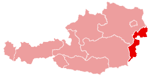 |
Source: Wikipedia, David Klaus
Lower Austria
Lower Austria
Niederösterreich / Lower Austria | Provincial flag | Provincial official flag |
 |  |
| Regional character | On the historical character |
 |  |
|
| Basic information |
| status: | spolková země Rakouska |
| State capital: | Sankt Pölten |
| largest city: | Sankt Pölten |
| ISO 3166-2: | AT-3 |
| zemská hymna: | Oh Heimat, to love you |
|
| Lower Austria map Austria |
 |
| Policy |
| zemský hejtman: | Erwin Pröll (ÖVP) |
| Provincial Government: | ÖVP, ROD, FPÖ |
| složení zemského sněmu(56): | ÖVP 31
ROD 15
FPÖ 6
Zelení 4 |
| last election: | 9. března 2008 |
| the next election: | březen 2013 |
| Population |
| resident: | 1 545 804 (1. January 2011 (2.) |
| population density: | 81 obyvatel/km² |
| Geography |
| area: | 19 178 km ² (1.) |
| geographic coordinates: | 47° 25′ – 49° 1′ S, S.
14° 27′ – 17° 4′ v.d. |
| the highest point: | 2 076 m (Schneeberg) |
| lowest point: | 139 m (obec Berg) |
| Administrative division |
| periods: | 4 statutární města
21 districts |
| judicial districts: | 32 |
| Municipalities: | 573 |
| – z toho měst: | 75 |
| – z toho městyse: | 326 |
| Map of districts and municipalities of Lower Austria |
 |
Lower Austria nebo i Lower Austria (německy Niederösterreich) je spolková země na severovýchodě Rakouska, obklopující svým územím Vídeň, která byla do prosince 1921 její součástí. Do roku 1920 patřily k Dolním Rakousům také nynější česká území Západní Vitorazsko,Valticko a Dyjský trojúhelník (so. České Rakousy). Dolnorakouskou metropolí je od 10. července1986 Sankt Pölten (česky Svatý Hypolit). She was previously the capital of Vienna. Od roku 1997zasedá v Sankt Pöltenu i dolnorakouský zemský sněm. Trips to Austria on-line
Na severozápadě a severu sousedí s Českou republikou (na severozápadě Čechami, na severu s Moravou), na severovýchodě na řece Moravě se Slovenskem. Furthermore, within the borders of Austria Lower Austria and Vienna, na západě s Horními Rakousy, na jihu se Štýrskem, the southeast sBurgenlandem.Geografie
Celou zemí protéká od západu na východ evropský veletok Dunaj, v jehož okolí a též při řece Moravě zde převažují nížiny. Severovýchod Dolních Rakous tvoří převážně pahorkatiny a nížiny, zatímco na severozápadě převažují vrchoviny. Na jihu Dolních Rakous se zvedají Alpy, které na hranici se Štýrskem dosahují nadmořské výšky přes 2000 meters. The highest mountain in the Lower Austrian Alps with its 2 076 metry Schneeberg zvaná též Klosterwappen.
Source: Wikipedia, David Klaus
Accommodation
Upper Austria
Upper Austria
nebo i Upper Austria (německy Upper Austria), the Land to the north of Austria. Its capital is Linz (German Linz), lying on the European mighty Danube, which flows north of Upper Austria from west to east. In the Danube River in the Bavarian town of Passau river flows Inn, which make up a large part of the Upper Austrian-German border. Other rivers include the Enns (Enns), forming part of the land border with Lower Austria; then Krems, Large Muehl, Small Muehl, Naarn, Steyr, Traun, Aist chi Antiesen. Trips to Austria on-line
Lakes, Land to the south of the Salzkammergut (Salzkammergut) are many beautiful lakes, which include Almsee, Attersee, Gosausee, Hallstatt Lake, Irrsee, Langbathsee, Mondsee,Offensee, Traunsee a Wolfgangsee.
Upper Austria / Upper Austria | Provincial flag | Provincial official flag |
 |  |
| Regional character | On the historical character |
 |  |
|
| Basic information |
| status: | spolková země Rakouska |
| State capital: | Linz |
| Upper Austria Map of Austria |
 |
| the highest point: | Hoher Dachstein (2 995 m n. m.) |
| lowest point: | Article (239 m n. m.) |
Source: Wikipedia, David Klaus
Accommodation
Styria
Styria
(German Steiermark, slovinsky Styria) Land is in the southeast of Austria. In terms of area is the second largest Austrian province, its area is 16 388 km ². It borders with Slovenia and Austria within the borders with the provinces of Upper Austria, Lower Austria, Salzburg, Burgenland and Carinthia. Today Province of Styria includes about 2/3 area full of Styria, which included the so-called.
Trips to Austria on-line
Lower Styria, which belonged to since 1918 the Kingdom of the Serbs, Croats and Slovenes (later Yugoslavia), and is now part of Slovenia. Austrian province of Styria is also Slovenians called "Upper Styria" (Upper Styria). In Austria, the term "Upper Styria" is used for the area around the town of Bruck an der Mur in the north of the Land. Styria was relatively short period included volume Czech and Alpine countries under the rule of Ottokar II. - In fact since 1261 do 1276. Hollywood star and former California governor Arnold Schwarzeneggerse born and raised in Styria, as well as the laureate of the Nobel Prize for Literature for the year 2004 Elfriede Jelinek. Styria is divided into 16 districts (Districts) a statutory town (Statutory) Graz.
Styria / Styria | Provincial flag | Provincial official flag |
 |  |
| Regional character | On the historical character |
 |  |
|
| Basic information |
| status: | spolková země Rakouska |
| State capital: | Graz |
| largest city: | Graz |
| Map Styria Austria |
 |
Alpine Club
Austrian Alpine Club (ÖEAV) – Austrian Alpine Association
(OeAV) Founded in 1862 today with your 400000 members of Austria's largest climbing association. OeAV is a non-partisan association of community-oriented tourism, mountaineering, mountain outputs, travel, instructors, Alpine skiing, ski-running, protection of nature and environment, youth work, Elderly Care, publications, scientific activities and many more.
Trips to Austria on-line
An important area of work is keeping his OeAV more than 500 huts and care for alpine trails network.
Search huts.

Benefits of membership Alpenverein:
- horské pojištění léčebných výloh (detail below)
- 50% slevu za přenocování na horských chatách v Rakousku a zahraničí
- The same use rights are in huts German Alpine Association (DAV), Swiss Alpine Club (SAC), Liechtenstein Alpine Association (LOW), Italian Alpine Club (CAI), French Alpine Club (CAF), Alpine Association of South Tyrol (AVS), Spanish Mountaineering Association (FIVE), Slovenian Mountaineering Association (PZS) and the Greek Alpine Club (CAH).
- Austrian Huettenmarke guarantees the full right to use and corresponding discounts for the tourist huts by Friends of Nature (TVN), Austrian Tourist Club (OeTK), Austrian Alpine Club (OeAK) and some local mountaineering associations.
- Reduced rates of more than 90 valley lodging houses and contractual Alpine Association (private inn located in the valleys).
- Discounts on certain lifts and lifts and bus routes Federal
Benefits at Alpine huts Union:
- Priority admission (allocation of places to sleep before outsiders).
- Exclusive opportunity to order in advance of sleeping places.
- Exclusive qualify for discounted food and drink for climbers and water for tea.
- Possibility to use self-service area, so. Winterraumů.
Alpenverein insurance – insurance protection:
- Climbing workmen's compensation insurance (across the board to 3 million for each injured person), baggage insurance in huts and transport cableways
- European legal expenses insurance to 32703,- EUR. Více viz. všeobecné podmínky.
- Alpine Club Worldwide Service: the cost of rescue: do 25000 EUR, transport a repatriace: unlimited, stay in a stationary hospital: do 10000 EUR. Více viz. všeobecné podmínky.
Price membership Alpeneverein Member Contributions for 2014:
Group A: 1550,- CZK
adult age group 26-60 let (roč.1951-1985)
Group B: 1265,- CZK – discounted membership for:
partners, members of the same section from group A (partners must have the same place of residence)
seniory od 61 let (in year. 1950)
juniory od 19-25 let (year. 1986-1992)
students to 27 let (Must be accompanied by proof of!)
widow OeAV member of the same section
Disabled, min.70%
Group C: 725,- CZK
children / youth in 18 let (from year. 1993)
It is also possible – permanent disability insurance
Alpenverein Rakouský alpský svaz, Prague-Innsbruck section
Gesaeuse
Gesaeuse
In the middle of Europe is a small country called Austria. Austria boasts six national parks, one of them is known as Gesaeuse. Let yourself be carried away by the beauty of nature and visit Austria! Gesäuse National Park is with its mountainous landscape areas, whose beauty is breathtaking. The Austrian national parks is the youngest and flat over 11.000 hectares third largest. The landscape is characterized by rocks, forests and waters. Based on the many significant differences
at an altitude can be found in the National Park Gesäuse number of very diverse locations and, consequently, many animal and plant species.
The highest point of the National Park is Hochtor. (2369 m.n.m).
Massive Hochtoru je, as well as the entire Ennstal Alps, built of limestone. Current chiseled features of this peak were formed by glaciers, previously available on its slopes. Remained after them karyHaindlkar, Tellersack, Steinkar a Schneeloch. For Hochtor are also characterized by numerous shapes alpine karst – especially škrapy and cave niches. The steepest slopes are Hochtor northeast, which are formed by 900 m high wall. Overall Hochtor rises above the valley of the Enns 1800 m

- From the south of the village Johnsbach – marked paths No.. 4 and 664 – through meadows Untere Koderalm, boiler Ronnerstein and Schneeloch (some challenging sections – UIAA II)
Length: Johnsbach – Rinnerstein – Hochtor (4,5 h.)
- From the east from Hesshütte over Josefinensteig, final 200 meters of altitude is conducted as klettersteig over the ledge ridge Gugelgrat (UIAA I ). The cottage Hesshütte (1699 m) You can arrive from all four cardinal directions (south from Johnsbach, east of Hartelsgraben, from the north and from the west Kummerbrücke from Haindlkar Hütte). The most attractive is Wasserfallweg of Kummerbrücke (1 km long klettersteig, difficulty A / B).
Length: Kummerbrücke – Water trap – Hess hut (3,5 h.) – Hochtor (2,5 h.)


Source National Park Gesäuse, David Klaus
Locality: Styria, Admont, Hieflau, Jonsbach
Accommodation Gesäuse
Linz
Linz
(German Linz) is the capital of the Austrian province of Upper Austria. S 189 500 residents (detail to 31. December 2008) is the largest city of Upper Austria and Vienna and Graz, the third largest in Austria. It is situated on the Danube and covers an area of 95,98 km ².
Trips to Austria on-line
Attractions

Pöstlingberg pilgrimage church

Other Dom, view of the main square
- Pilgrimage Church – Basilica Pöstlingberg: Symbol of, Pilgrimage Church on the hill high 537 m. n m., Built between 1738 – 1774
- Pöstlingbergbahn: adhesion path with the largest slope in the world (slope 10,5 %), year built 1898. The final station in the tower fortifications
- Linzer Grottenbahn: na Pöstlingbergu, in the former fortress, open 1906, Circular narrow-gauge railway
- Mariä-Empfangnis-Dom: also called Neuer Dom, built in years 1862 – 1924, novogotická, from sandstone, with incomplete details; Austria's largest church, bandwidth CCA 20.000 people, Holy land. Stephen's Cathedral in Vienna, the second highest church tower (134,8 m)
- Alter Dom: Jesuit church year 1669 with two towers
- Cottage: Italian Renaissance, year 1564. Fountain of the year 1648.
- Main Square: the largest square on the Danube, Holy Trinity Column of the Year 1717 a radnicí Old Town Hall
- Country road: Country road (Provincial class) is the most important street of the city. Located on the many historic buildings and sights, eg. Ursulinenkirche a Karmeliterkirche). It is also important in terms of trade, is the third busiest (pedestrian) streets in Austria
- Parish Church: Parish church in the late Romanesque foundations, baroquized year 1648. It houses the heart and guts of Emperor Friedrich III:
- Linz Castle: Linz Castle – the first mention of 799. Head of Emperor Friedrich III. Since 1966 it houses a museum
- St. Martin's Church: The first mention of 799, initially considered to be the oldest church of Austria, according to the latest research comes from the central building 10. or 11. century [4]
- Botanical garden: about 100.000 visitors per year, lies on top of Bauernberg, area 4,2 has, 8.000 plant species
- Hotel Zum Schwarzen Baren: The Black Bear Hotel – Birthplace tenor Richard Tauber
Source: Wikipedia, David Klaus
Innsbruck
Innsbruck
(Inšpruk outdated or Inomostí, Latin Oenipontum) is the capital of the Austrian province of Tyrol. It is located in the Inn valley, in the immediate foothills of the Alps, about 30 km north odBrennerského Pass, the easiest way to Italy. In the immediate vicinity of the high mountains, na Sever Hafelekar (2334 m) and on the south Serles (2718 m).
Trips to Austria on-line
The name is composed of German names of the Inn River bridge Brücke, therefore means bridge over the River Inn. Innsbruck is the fifth largest city in Austria (s 118 000 residents, after Vienna, Graz, Linz aSalzburgu). In urban agglomeration live about Innsbruck 165 000 resident. Innsbruck has a university and other universities, is the seat of a bishop and a popular destination for tourists and skiers.

Innsbruck, judgment sv. James
Sights
- The Golden Roof (Golden Roof), Late Gothic oriel Emperor Maximilian I. z let 1497-1500
- Baroque dome of St. James from years 1717-1724 on the site of an older church from 12. century
- Imperial Palace (Hofburg) associated with court church (Hofkirche) crossed Emperor Maximilian I. Habsburg as the headquarters and residence one year ago 1500, Lock the park was expanded in the late Baroque style around 1760.
- Court church (Hofkirche), Renaissance triple nave had set up his residence when Emperor Maximilian I., within its marble mausoleum with wrought iron grilles, surrounded by bronze statues standing Roman emperors from Charlemagne, through conquest of the Holy Land to the Habsburg rulers and their wives. Unique Renaissance sculptural work comes from the metal casting workshop of the sculptor Hans Vischer younger Nuremberg.
- The old house, Baroque building from 1725-1728
- Stone Plague Column of the Holy. Anna in Baroque style modeled C. Benedetti roku 1706
- Wilten Premonstratensian monastery with a baroque church of years 1751-1756 Built on the site of an early Christian church 5. century Romanesque monastery of 12. century
- Ambras Renaissance chateau built the Archduke Ferdinand of Tyrol on a hill southeast of the city, přensel his art collection from Křivoklátu, which it still resides under the administration of the Vienna art history museum
- Lift leads from the city to Hungerburg and over 1800 m long.
- Bergisel ski jump was built for the Winter Olympics year 1964, the jumper on it Dalibor Motejlek received only (bronze) medal for the Czech Olympic Team; Today it is known from the bridge of the annual Four Hills Tournament.
| Innsbruck |

A panoramic view of the city from the Town Hall Tower |
sign | |
| altitude: | 574 m n. m. |
| state: |  Austria Austria |
| Land: | Tyrol |
| |
Tauplitz, Altaussee
Region Tauplitz, Altaussee

located at a height 850 – 2 000 m.n.m. offers a unique natural beauty, přátelskost poskytovatelů služeb a idylický život v malebných vesničkách.
For lovers of cycling routes is prepared from a number of outputs to challenging forest roads and mountain pastures.
Trips to Austria on-line
Interesting cycling are Salzkammergut Radweg long 47 km, která vede od zámku Trautenfels v Ennstal přes rašeliniště Laasen a národní chráněnou oblast Ödensee až k Blaa-Alm v Altausee.
Jiné cyklotrasy vedou okolo pěti jezer nebo v okruhu solné komory až k Hallstattskému jezeru.
In addition to the above options can be used accompanying passageways and plan your own cycling trip.
Tauplitz, Altaussee found at an altitude of 850 – 2 000 m n. m. This is one of the oldest ski areas Styria. It is located in the Salzkammergut. There are very good snow conditions.
Most of the winter season there is good natural snow. In case of bad weather, but you do not have to worry about, that a great nezalyžujete. There is a state of the art snowmaking equipment.
There are many opportunities for cross-country skiing. Less terrain here but you will find most skiers and snowboarders.
Accommodation Tauplitz, Altausse-prepare

Grossglockner
Grossglockner (3798 m)
je nejvyšší hora Rakouska, která se nachází ve skupině Glockner patřící do Vysokých Taur a na hranicích spolkových zemí Korutany a Tyrolsko.
Slim, ledovcovo-skalnatá pyramida v bočním výběžku hlavního alpského hřebene připomíná svým tvarem zvon – odtud název „Velký zvon“ (Grossglockner).[edit]Name mountains
Trips to Austria on-line
Outputs
Jako první vystoupil na vrchol Großglockneru 28. července 1800 pětičlenný tým z početné expedice, která byla zorganizována na popud biskupa Franz-Xavera Salm-Reifferscheida z korutanské diecéze Gurk. Senior members of the group were brothers Martin and Sepp Klotz, farář Horasch a dva tesaři. Today, he is the Grossglockner number of climbs. In addition to the normal rule, overcrowded routes are very popular climbing:
- Pallaviciniho kuloár, Vintage Ice tour, sklon cca 55° touto cestou byl sjet na také lyžích a Iva Filová jako první žena zdolala tento úsek na lyžích
- Stüdlgrat, classic rock and combined tour, under conditions
- Mayerlrampe
Glockner Group
Mountain group Glockner (Glocknergruppe) is one of seven parts, na něž se člení Vysoké Taury. Leží na území Korutan, Tyrolska a Salcburska. Na severu je ohraničena řekou Salzach. In the west it is separated from the group Granatspitzen Stubachtal from a group Venediger Tauerntal. Southern limit is Kalser Tal and Leitertal. From the east it off saddle Hochtor, Seidlwinkl a Rauristal. K významným horám patří kromě Großglockneru také Großes Wiesbachhorn (3564 m), Johannisberg (3453 m), Hoher Riffl (3338 m), Fuscherkarkopf (3331 m), Kitzsteinhorn (3203 m). Glockner Group is one of the most popular oblastemrakouských Alps, nejznámějším střediskem je Kaprun. Velká část skupiny náleží do Národního parku Vysoké Taury (National Park Hohe Tauern).
The core of the park consists of original Alpine region. Bulky and high peaks, kterým vévodí Grossglockner [3798m] a Großvenediger [3674m], steep cliff, the eternal ice (altogether 169 glaciers) and glacial rivers and streams define the character of the landscape. The plant kingdom in this national park is extremely rich with a wide variety of species as well as all the fauna is very strictly protected. One of the wonders of this area is glacier buttercup, which survives only on glacial moraines, but it can be seen even on top of Grossglockner. Ze stromů dosahují borovice limba a modřín stáří až 1000 let. They live zdekamzíci, svišti, kozorožci i alpští mloci. Je zde možné spatřit i orlosupa bradatého a orla skalního.
Masiv Grossglockneru
This powerful and extensive massif, which is the peak 3798 m vysokého Grossglockneru nejvyšší v celých Východních Alpách, is composed of many kinds of minerals. Masiv Grossglockneru je tvořen z ruly, na povrchu je však rula doprovázena místy i poměrně mocnými vrstvami břidlice. Velice rozšířený je výskyt kombinacevápenec s břidlicí a slída. Jádro masivu Grossglockneru je tvořeno ledovcem Pasterzenkees. The glacier has a surface 19,5 km ² and is in terms of surface area the largest glacier of the Eastern Alps. It is a long valley glacier 9,5 km. It is powered with glacier, které stékají z okolí vrcholu Johannisberg a obou vrcholůBurgstall. Glacier ends of tanks Margaritzen-Stausee, where they are trapped by the water. Glacier Pasterzenkees is under the hut Hofmannshütte wide 1,5 km and its thickness reaches 250 meters here. The speed of movement of an iceberg is around 100 meters per year. Today, it is estimated the total volume of ice mass at 2 km ³. In the last century, however, this value is at least a third more. Leading Austrian glaciologist Paschinger even estimated, that in 1856 was long glacier 11 km and its surface was 36 km ². Means, that the surface of the ice masses reached almost to the present prospect of Kaiser Franz Josefs Höhe.
| Grossglockner |
Großglockner z jihu |
| Top | 3798 m n. m. |
| Mountains | Hohe Tauern, Alps |
| Continent | Europe |
| States | Austria |
| First ascent | 28. července 1800 |
| Rock | green slate |
| Note | the highest mountain in Austria |
|
Saalbach Hinterglemm
Údolí Saalbach Hinterglemm

Enjoy the mountains and enjoy the nature:
Large stage for active cyclists and hikers, kochající with nature lovers and families – léto v Údolí her Saalbach Hinterglemm nabízí vhodnou nabídku pro každé přání na dovolené.
Trips to Austria on-line
Mountain valley world Glemmtal accompanies tourists on every step unrivaled panorama of the High Taurn to the Massif Leogang. Full, where are the cool season home fans skiing and snowboarding, waiting in the summer walkers and Alpine enthusiasts 400 km of marked hiking trails.

Amsterdam
Amsterdam
nebo též Amsterodam je hlavní město Nizozemska since 1808. However, it is not established in the Parliament, government or royal family, tyto instituce mají své sídlo v Den Haag. V současnosti je největším nizozemským městem, its financial and cultural center. The town has 761 395 resident (Census 31. May 2009), who profess to 177 different nationalities (April 2009). Amsterdam je jedním z měst konurbace Randstad.
Historie města Amsterdam sahá až k roku 1000, Since when was this marshy area called Aemestelle. Around the swamps were dug drainage channels. Low water levels in the canals maintained by dams. And 13. century dam was erected at the mouth of the river Amstel, so incurred on behalf of Amsterdam. Poprvé byl Amsterdam zmíněn v roce 1275 in the document, in which the monarch Floris V. frees his people from charges. In about 1306 Amsterdam received municipal rights. From 14. století město vzkvétá zejména díky obchodu s hanzovními městy, eg. s Hamburkem. From 15. century is commercially the most important Dutch city. The city continued to expand, but because it lies on the marshlands, had at its next expansion dig canals and construction of houses was based on wooden stilts.
Na našich webových stránkách si můžete rezervovat hotely, guesthouses , hostely a další tipy accommodation v Amsterodamu on-line.
Výhodné a levné akční letenky do Amsterodamu here
Sell of the journeys Zájezdy do Nizozemí on-line

The oldest architectural monuments include the two originally Gothic parish churches, a to Starý kostel Oude Kerk ze 14. century a Nový kostel Nieuwe Kerk, both now used as an exhibition hall. Far younger – up to 19. century- the Jesuit church of St.. Francis Xavier and still Catholic parish church. Santa with Baroque dome.
Z veřejných staveb nejstarší je gotická obchodní Váha s věží, they 14. century, which gradually rebuilt served various purposes.
Historické centrum Amsterdamu je zastavěno převážně domy ze 16. – 17. century, that in the Netherlands called Golden Age. At that time, built a system of concentric channels around the center of the old town. Tři nejznámější kanály se nazývají Herengracht (channel Lords), Kaizersgracht (channel Emperors) and Prinsengracht (channel princes).
Modern monument in front of the University of 1978 vztyčen nizozemskému filozofovi Baruchu Spinozovi, who lived and worked. Panel with text about his life, painted portrait and books are displayed at the Jewish Historical Museum.
The city is famous for its museums and galleries. Na rozlehlém Muzejním náměstí Museumplein stojí blízko sebe situována tři muzea: Rijksmuseum, Van Gogh Museuma Stedelijk a budova opery.
- Rijksmuseum (Czech Reich Museum) is the largest art museum in the Netherlands. Vzniklo v době republiky Batávie roku 1798, after he was in 1795 svržen místodržitel princ Vilém V. Oranžsko – Nasavský a jeho umělecké sbírky zabaveny. Collection 200 most prominent buildings were opened in 1800.
In the early halls Rijksmuseum are on a ship model, portraits of naval heroes, maps and handicraft products of the Dutch maritime trade illustrated history 16.- 18. century. Are introduced portraits and emblems government Dynasty princes Orange-Nassau and group portraits of leaders. Mezi nimi k největším plátnům patří Hostina Svatojiřského spolku ostrostřelců, held on the occasion of the signing of the peace agreement signed after the Thirty Years' War 1648 Münster, obraz namaloval Bartholomeus van der Helst. The largest part of the collection consists of paintings and sculptures. In 2011 – 2012 the historic neo-Renaissance building of the museum (built between 1876 – 1885) fixes, two thirds of the collections are closed. Therefore, at the beginning of exposure to oil paintings and drawings of Dutch and Flemish painters from 17. century. Nejznámějšími obrazy jsou Noční hlídka, Židovská svatba, Portraits, autoportréty a zátiší od Rembrandta, obrazy Mlékařka a Žena čtoucí dopis od Jana Vermeera, portréty Franse Halse nebo Žena s lékařem a Veselá rodina od Jana Steena.
- Van Goghovo muzeum prezentuje největší sbírku obrazů Vincenta van Gogha na světě. It has also saved much of letters, which the artist wrote to his brother Theo. Dále jsou v suterénu vystaveny obrazy Paula Gauguina, Claude Moneta, Felix Valottona, Pabla Picassa a Henri de Toulouse-Lautreca.
- Stedelijk museum prezentuje velkou sbírku moderního umění.
- Dům Anny Frankové, in which during the Second World War, sheltering Jewish family dentist Frank to disclosure and execution in 1944, is dedicated to the exposure of the secret life of the family. Fourteen- až patnáctiletá dcera Anna Franková psala svůj deník, which was published after the war in many languages.
- Židovské historické muzeum spravuje významné historické a umělecké sbírky nizozemských židovských rodin od 16. do 20. century building attached to the old synagogue. Proti němu stojí Portugalská synagóga.
- Botanická zahrada je situována nedaleko odtud na břehu kanálu.
- Námořní muzeum sídlí v budově bývalé Východoindické námořní společnosti (VOC). In four of the building feature the collections of documentary subjects, further in the south wing is an interactive exhibition on the three sections. The first deals with the history of the Dutch overseas expeditions, the other on whaling, a third of the ships and nánmořnících. Before the museum moored exact copy of one of the first naval ship of VOC, is accessible to museum tickets.
- Historické muzeum města Amsterdamu se zaměřuje na slavné etapy vývoje města, famous family and Documents.
- Begijnenconvent je bývalý konvent, Kostel a kaple bekyň. It was created in 15. Century of several houses, in which they lived unmarried women pious virtuous life. Medieval houses burnt, later constructed buildings in 19. century came under the Anglican Church, still serves its purpose.
- Rembrandthuis – Rembrandtův dům je památníkem malíře s přesně rekonstruovanými interiéry od kuchyně přes přijímací sál s vystavenými obrazy, Loznati workshop. Also exhibits significant collection of Rembrandt prints and měditiskových boards.
Warsaw
Warsaw
(polsky Warsaw, pronunciation is the main (since 1596) and largest city of Poland. In 2010 should 1 720 781 resident, with surrounding agglomerations 3 003 000. Warsaw situated in central Poland in the historic Mazovia in the middle reaches of the Vistula in Warsaw Basin at an average altitude 100 m n. m. Zájezdy Polsko on-line

Warsaw it is also the capital of Mazovia Province. In the capital, is developed industry, especially manufacturing, steel, electronics and automotive.
Flanked by more than 60 educational institutions, especially Warsaw University (University of Warsaw), University of Cardinal Stefan Wyszynski, Warsaw University of Technology (Warsaw University of Technology), Warsaw School of Economics (School of Economics) and further. There are over 30 theaters, including the National Theatre and opera and has the headquarters of the National Philharmonic Orchestra. Accommodation in Warsaw on-line
The first fortified settlement in what is now Warsaw settlement was Bródno v 9. and 10. century and Jazdów in 12.a 13. century. After, What Vévoda of Plock, Boleslav II. Mazovia attacked in 1281 the Jazdów, Founded new headquarters at the small fishing village Warzsowa. At the beginning 14. century, this place has become one of the seats of Mazovia Province and in 1413pak capital of Mazovia. After the extinction of the local provincial status line in 1526 Province was incorporated under the Polish crown. In 1529 Warsaw became the first seat of the Polish Sejm, permanently housed here Sejm since 1569. Year 1573 gave the name of Warsaw Warsaw Confederation, agreement of the Polish nobility tolerance of different religions in the Polish Kingdom. Accommodation in Poland on-line
Due to its convenient central location between Vilnius and Krakow in the Polish-Lithuanian Commonwealth Warsaw became the capital of the community and at the same time in 1596 the capital of Poland, here when King Sigismund III. Vasa moved the royal court from Krakow. Warsaw was the capital of the Polish-Lithuanian Commonwealth until 1795, when the monarchy was attacked Prussia and Warsaw became the capital of the province of New East Prussia. Year 1807 the city was osvobozenoNapoleonovou army on the Vistula and the city becomes a metropolis Warsaw Regional. In roce1815 after Napoleon's defeat at Waterloo brings together former powers Austria, Russia and Prussia(The Congress of Vienna), according to which Poland was under the influence of imperial Ruska.To recreated a Polish constitutional monarchy under his influence. The uprising against Russian domination in a letech1830 1863 only increased repression against the Polish population.

After regaining independence of Poland after the end of the First World War in 1918 Warsaw again became the capital of the newly forming state. In 1919 Poland came into conflict with Bolshevik Russia on the historical territory of Ukraine and Lithuania. The Battle of Warsaw (1920) Polish troops completely destroyed the Red Army troops attacking the city and thus thwarted the attempt of Lenin and the Russian Bolsheviks to connect with German, French and Hungarian Bolsheviks to dominate Europe.
The Second World War was started 1. September 1939, when Germany invaded the western part of Poland. It was also 17. September 1939 attacked Poland from the east by the Soviet Union. Country capitulated after six weeks of fighting. West Poland was annexed by the German Reich and east to the Soviet Union. The central part of Poland including Warsaw was under the administration of the pro-Nazi government (General Gouvernment). During the invasion in 1939 Warsaw was bombed and destroyed 10 when 15% buildings in. Although it was a significant loss, in later times had to be Nazi plans for the city completely destroyed and preserved just as important transfer point.
During the Nazi occupation of the city were all higher educational institution immediately closed and Warsaw Jewish population – Several hundred thousand people, about 30 % the city's population - were herded into ghettos tzv.Varšavského. When the Germans as part of Hitler's "final solution" tried to liquidate the ghetto, there was a Jewish uprising. Despite the heavy shelling and outnumbered the ghetto remained defend nearly a month. After the fighting were those, survivors, massacred.
In July 1944 Soviet troops advanced through Polish territory, The Germans then retreated to Warsaw. Stalinnebyl favor of the idea of independence of Poland, Therefore, the Polish government in exile in London gave orders to the Polish underground Home Army ("Army"), to try to gain control of the city, before they arrive Russians. Dne 1. August 1944, when the Red Army approached the city quickly, Provincial army and most of the population started Warsaw rebellion.
Despite Stalin's hostility towards Poland Poles expected, the Soviet soldiers help them against their common enemy. However, when the Red Army came to Warsaw, Soviet offensive was abruptly stopped and the Germans could ruthlessly suppress the uprising. Although the rebellion was the time scheduled for 48 hours, defenders keep 63 days. Finally had to surrender the capital of Poland. Home Army soldiers were taken to POW camps in Germany, civilian population was expelled from the city. Hitler, ignoring the agreed terms of surrender and ordered, that the city was razed to the ground, libraries and museums looted or burned. When 17. January 1945 Soviet troops crossed over the Vistula, found, that Warsaw has almost ceased to exist. Through 85 % the town was destroyed, including the historic Old Town and the Royal Castle. The surviving fighters Terran army Russian NKVD killed or sent to Siberia.[source?]
The number of victims of wartime events was then estimated at 800 000, These are primarily Jews and victims of the uprising.
After the war, taking power prostalinská government of President Bolesław Bierut and Warsaw became the capital of the communist Polish People's Republic. This naturally aspired urgent issue to address capital renewal. According slogans and then began “the nation to build a new Warsaw”. It was necessary not only to restore historic buildings and the Royal Castle, but mainly terraced houses. The original narrow streets, which were conducted in routes centuries old ways replaced by modern boulevards conducted in north-south and east-west direction, linked together roundabouts. Even though much of the original houses replaced, Some of the early 20. century and earlier are preserved. Many churches were then restored to its original appearance.
New dominating metropolis became the Palace of Culture – built in the style of socialist realism, like “gift peoples of the Soviet Union, the Polish people”. It was first completed in 1955.
In 1980 was renovated historic Old Town entered into the historical heritage.
The development of road transport in the spirit of the new city was accompanied by construction of transport. New Central Station, lying on an important thoroughfare Warsaw Jerozolimskie Alleys, is located underground, and with a track, led under the center of the metropolis helped simplify the traffic situation in the city and make quick connections between eastern and western trains. Tram-way, Warsaw which has already pre-war times, the zmodernizovala, the new high-speed roads appeared moderníautobusy. That konci 80. years, began the construction of the metro.

Metropolis but still waiting for big development. Houses from the fifties and sixties began soon add high-rise buildings. Already in 70. years started to grow first in the north and the center of town, silhouette metropolis, then added buildings such as Mariott Hotel and Blue Center. New times a year 1989 then brought the full opening of western investors. Creating additional office buildings, but also business center.
Krakow
Pages preparing
Zájezdy do Polska
Dachstein
Dachstein

is a mountain massif in the Northern Limestone Alps. The highest peak, Hoher Dachstein, is the second highest mountain in Northern Limestone Alps. It is the highest mountain in the Austrian province of Styria(Styria) and Upper Austria (Upper Austria), because it is over the top provincial border between the provinces. On the shores of Lake Hallstatského was discovered one of the oldest human settlements.
Zájezdy do Rakouska on-line
| The highest point | Hoher Dachstein(2995 m n. m.) |
| Parent Unit | Northern Limestone Alps |
| Neighboring units | Totes Gebirge,Salzkammergut mountains, Tauern |
| Continent | Europe |
| States | Austria |
| Rocks | limestone |
| Basin | Enns |
Dachstein Mountains, an area of 900 km ². It is located in Austria, on the border of Upper Austria,Štýrska a Salzburska. In the north it is bordered by massive valley Kainisch Traun, the south is separated from the Low Taur řekyEnns long valley and west of the massif Tennengebirgeúdolím Lammer.
Geography – Dachstein massif covers an area of approximately 20 × 30 km. Most of the area consists of undulating plateau with many karst phenomena. The highest peaks are located in the periphery, and fall to the south, especially high walls (when 1100 meters) Valley. Dachstein is also the site of the northernmost and easternmost while glaciation in the Alps. There is a Hallstatt glacier, Big Gosauský glacier, Small glacier Gosauský, Schladmingerský glacier, Edelgriesský ledovec, Schneeloch, North and South Torstein Torstein.
Dachstein massif is divided into several separate groups. Apart from the very top of the Dachstein it is located in the north of separate peak Hoher Sarstein(1975 m). To the west lies the Gosaukamm group with the highest peak Grosser Bischofmütze (2459 m). East from the top of the Dachstein plateau is arid plateau called Am Stein (1720 m). The last group of mountain located entirely in the eastern territory is lonely peak Grimming (2351 m).
The Dachstein massif two chair lifts. They Dachsteinseilbahn from Obertraun and Dachsteinsüdwandbahn. Massif also passes through remote alpine cestaVia Alpina. There is a system of ice caves consisting of Dachstein-Rieseneishöhle, Dachstein Mammoth Cave a Koppenbrüllerhöhle.
Mountaineering
First reached the top of the Dachstein Peter Gappmayr in 1832, Gossauský way through the glacier and west ridge. There are a number of different climbing routes and secured. Popular routes are secured Dachstein Westgrat and Johann Klettersteig. The climbs are known Steinerweg and Pichlweg. Do Dachstein massif also includes Gosaukamm, where one of the popular highlights Grosser Bischofmütze, Tom Thumb, Lower Grosswandeck.

Huts: Grimming hut
In Dachsteinmassiv find a cottage belonging to a private club or Alpenverein and Naturfreunde.
Winter sports resort – Schladming
- Schladming (745 m) - Famous ski resort in the valley of the river Enns. The most important administrative town in the south massif.
- Ramsau (1136 m) - A small village under South stmnou Dachstein. Major foothold in the southern wall outlets. Dachstein cable car leads from here to Südwandbahn Hunerkogel (2685 m).
- Gosau (779 m) - Village in the vastness of the Gosau Valley north of the Dachstein. The basis of the outputs of the Dachstein from the north. In the valley there are also lakes Vorder and Hinter Gosausee. Gosau is also the starting point of the ski area Dachstein West.
Vienna
Vienna
(německy Wien) je hlavní město Rakouska, současně také statutární město a zároveň od1. January 1922 jedna z jeho spolkových zemí, zcela obklopená územím spolkové země Dolní Rakousy. Leží na řece Dunaj a se svými 1,7 million inhabitants, the largest Austrian city and at the same time the most important cultural, political and economic center of the country. Historické centrum Vídně bylo v roce 2001 zapsáno na Seznam světového dědictví UNESCO. V seznamu měst podle kvality života
Zájezdy do Vídně
Wien / Vienna | Zemská vlajka Vídně | Provincial official flag of Vienna |
 |  |
| Velký znak Vídně | Little sign of Vienna |
 |  |
|
| Status: | spolková země Rakouska astatutární město |
| Founder of: | Romans |
| The year of foundation of the city: | 15 lecture. n. the. |
 |
| Area: | 414,65 km ² |
| – z toho souš: | 395,29 km ² (95,33 %) |
| – of the waters: | 19,36 km ² (4,67 %) |
| The highest point: | 542 m
(Hermannskogel) |
| The lowest point: | 151 m
(Lobau) |
Vídeňská pánev je díky své výhodné poloze a příznivému klimatu nepřetržitě osídlena už odmladší doby kamenné. Jméno dostalo místo po keltské osadě Vedunia, which means forest stream.
Kolem přelomu letopočtu bylo území dobyto Římany, who at the site of the present city built a military camp and the adjacent town. Neslo jméno Vindobona a jeho úkolem byla obrana severní hranice říše před germánskými kmeny. Year 180 při tažení proti Markomanůmzde zemřel císař Marcus Aurelius. Romans left the city in 5. century, but the settlement at the place never quite went on and in the Middle Ages was the Roman foundations restored back into town.
Druhé obléhání Vídně Turky (1683) podle oleje Franze Geffelse
Year 1155 učinil markrabě Jindřich II. Jasomirgott Vienna hlavním městem Rakous, na základěPrivilegia minus (1156) promoted to the Duchy. Při návratu z křížové výpravy byl na území města zajat anglický král Richard I. Lionheart. Ransom made up for his release, he became a stimulus for the development of, important business centers in the Danube region. Za vlády prvním Habsburků se Vídeň jako jejich sídelní město stala na čas centrem říše, které se po nástupu Lucemburků přesunulo do Prahy. Year 1365 zde byla založena třetí nejstaršíuniverzita severně od Alp, in 1438 se Vídeň opět stala rezidenčním městem císařů. Nedlouho poté zde bylo zřízeno i biskupství (1469). In the twenties 16. century Vienna became the center of the Danube monarchy, which included Austria, české a uherské země a s krátkými přestávkami jím zůstala až do roku 1918. V letech1529 a 1683 byla u Vídně odražena turecká vojska, která do té doby úspěšně postupovala přes celý Balkán.
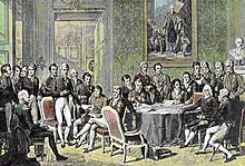
Vídeňský kongres stanovil po napoleonských válkách novou velmocenskou rovnováhu v Evropě
The city was the center of one of the European powers and the residences of the Roman emperor and his court. Běhemnapoleonských válek se stalo hlavním městem nově vytvořeného Rakouského císařství, roku 1814 byl do Vídně svolán kongres, that addressed the new post-war order in Europe. Second half 19. century and the beginning 20. century was marked by the rapid development of. Na místě hradeb vznikla rozsáhlá okružní třída lemovaná veřejnými budovami – Ringstraße, was newly rebuilt a substantial part of a former suburb connect with inner city. Before the First World War, the population exceeded two million, Vienna was the fourth largest city in the world. It was also an important center of artistic life.
Velkou ranou pro město byl rozpad Rakousko-Uherska v roce 1918. Město ztratilo své zázemí v obrovské říši a stalo se předimenzovaným centrem malého Rakouska, postihl ho i odchod převážné části českého a slovenského obyvatelstva do nového Československa (roku 1910 zde žilo cca čtvrt milionu Čechů a Slováků). Year 1921 se Vídeň stala samostatnou spolkovou zemí. Mezi válkami byla baštou socialismu v Rakousku, při krátké občanské válce roku 1934 stála v centru bojů. Year 1938 však již její obyvatelé připravili triumfální uvítání Adolfu Hitlerovi. Rakousko bylo do roku 1945 připojeno k Německu a Vídeň ztratila pozici hlavního města. Po skončení války bylo město rozděleno na čtyři okupační zóny a SSSR, USA, Francie a Velká Británie spravovaly Vídeň deset let.
Lake Como
Jezero Lago di Como
Lake Como (italsky Lake Como nebo Lario podle latinsky názvu Lacus Larius) je fjordovité jezero v Itálii jež se v podobě vidlice „Y“ rozdvojuje k jihu (Lago di Lecco). Je bohaté na ryby. Nachází se na územíprovincií Como a Lecco v Lombardii. Má rozlohu 146 km ², je 51 km dlouhé a 4,5 km široké. Po Gardském jezeře a Lago Maggiore je třetí největší v Itálii a se svou maximální hloubkou 410 m patří mezi nejhlubší v Evropě. Leží v nadmořské výšce 197 m. Zájezdy-pobyty Itálie
| Area | 146 km ² |
| Length | 51 km |
| Width | 4,5 km |
| Max. depth | 410 m |
| Height. height | 197 m |
| Water supply | Adda, Mero |
| Runoff water | Adda |
| Locations | As, Lecco |
| Area | Lombardy |
| States | Italy |
| Continent | Europe |
Lake Como (italsky Lago di Como nebo Lario podle latinsky názvu Lacus Larius) je fjordovité jezero vItálii jež se v podobě vidlice „Y“ rozdvojuje k jihu (Lago di Lecco). Je bohaté na ryby. Nachází se na územíprovincií Como a Lecco v Lombardii. Má rozlohu 146 km ², je 51 km dlouhé a 4,5 km široké. Po Gardském jezeře a Lago Maggiore je třetí největší v Itálii a se svou maximální hloubkou 410 m patří mezi nejhlubší v Evropě. Leží v nadmořské výšce 197 m.Jeho břehy jsou většinou prudké a skalnaté.
Na východní a severozápadní straně je sevřeno poměrně vysokými horskými masivy Alp (Monte Legnone, 2 609 m). Lesions at the, kde se v minulosti posunoval Addský ledovec a u Alta Brianza se rozděluje na dvě části. Jezero na severu začíná u města Colico a na jihu končí jihozápadní rameno u města Como a jihovýchodní rameno u města Lecco.
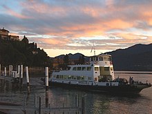
Trajekt Ghisallo, Varenna
Komským jezerem protéká řeka Adda (levý přítok řeky Pád). Flows into the lake near Colico and flows out at Lecco. In the southwestern arm is no significant inflow nevtéká. Druhým nejvýznamnějším přítokem je řeka Mero, přitékající z jezera Lago di Mezzola.
Thanks to the mild climate in the area is growing rich vegetation. Jezero je vyhledávaný turistický cíl s množstvím lázeňských míst aparků. Na jezeře je rozvinuté rybářství (trout, whitefish, carp) a místní lodní doprava. There are boat connections between městyVarenna, Menaggio Bellagio.
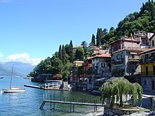

Bellagio
Paznaun-Ischgl
Ischgl, Galtür, Kappl, See
Skiing at the finest level, concerts with the participation of the world star in the Alpine metropolis lifestyle Ischgl, perfect treat for families in Galtür Silva Park, the best for the children in the Sunny Mountain Adventure Park Erlebnispark Kappl, zimní pohádka v See – Paznaun v Tyrolsku nabízí zimní zážitky v řádu superlativů a s maximální rozmanitostí Zájezdy Ischgl on-line
Ischgl – alpská metropole životního stylu
V Ischglu v tyrolském Paznaunu se myslí a žije v samých „nej“. In the winter here combines in perfect harmony offer excellent winter sports and unsurpassed range of entertainment. "Vesnic" in Ischgl 1.500 residents not only well-known, perfect and much decorated winter sports paradise, where live entertainment round the clock. Concerts Mountain Top oft he world stars to middle slopes represent a unique and fun, horské chaty zase nabízejí gurmánské požitky a exkluzivní lyžařskou gastronomii v prostředí avandgardní architektury. Ischgl is of course the perfect ski areas, incidentally the largest interconnected in Tyrol (240 kilometers of slopes) - With the most modern ski lifts and snow-sure until early May.
Silvapark Galtür
 Under the sonorous name of Silva Park is hiding concept, which brings a new dimension to winter sports just for families. The entire ski area is divided into specific complexes, that any fans of skiing and snowboarding lets you enjoy winter sports, something new to learn or try something new. For each level of proficiency in offering tailor-made complex with interesting tasks and challenges. When the first snow safari in the world, this area winter sports know in all its diversity. Spectacular and romantic at the same time is night skiing on floodlit slopes, Long over 2 kilometers. Despite all the "action" but remained Galtür such, What has always been: hot Tyrolean village with lots of charm and original traditions of the high altitude alpine landscape
This Kappl a
In the middle of the majestic mountain world is an idyllic mountain village of Kappl and See and invite you to ski right up to the pleasures of altitude 2.700 meters. The vast ski area is a guarantee nezapomenutelnéo winter experience for the whole family.
 Adventure park "Sunny-Mountain Erlebnispark" in Kappl stated in the enthusiasm of all children. With due diligence experienced instructors are here adepts little slowly and playfully learn to stand on skis. Generous conditions on the slopes, friendliness to families and single ratio of price to the services provided in the ski area is an attraction for visitors as well as locals. 33 kilometers of ski runs of all difficulty levels guarantees the unique pleasure of skiing for beginners and advanced.
Zájezdy Rakousko

Trails Ticket Prices
1.050 m – 2.872 m.n.m.
| easy | 70 km |
| middle | 183 km |
| difficult | 70 km |
| Overall | 323 km |
ACCOMMODATION REQUEST
Kitzbühel
Kitzbühel
(česky dříve Kobylí) je město v rakouském Tyrolsku ležící na řece Kitzbühler Ache, v nadmořské výšce 762 meters, mezi horskými vrcholy Hahnenkamm (1712 m) a Kitzbüheler Horn(1996 m). Je také administrativním centrem okresu Kitzbühel.
Zájezdy-lyžařské pobyty Kitzbühel
Kitzbühel is one of Austria's most famous tourist and sports centers. Ve městě a přilehlých obcích Reith, Aurach a Jochberg se nachází 516 accommodation businesses (thereof 6 five star hotels) with a total capacity 9200 beds.

Kitzbuhelerhorn
Na svazích hory Hahnenkamm se každoročně pořádají závody světového poháru v alpském lyžování. V létě se stává centrem golfu – v okolí města jsou dvě osmnáctijamková a dvě devítijamková hřiště a další se brzy začne stavět. Pravidelně se tu koná také jeden z turnajů ATP Generali Open. Since 1988 se také jezdí v okolí Kitzbüheler Alpenrallye, race of vintage cars.

Cockscomb
In the vicinity of the city's network of hiking trails and mountain roads with a total length of over 500 km – eg. na Hahnenkamm, Kitzbühel Horn, Schwarzsee.

- Kützbühel ski eyebolt, interactive
Kitzbühel-Kirchberg, slopes
800 – 2.000 m. n. m.
Trails, Lift ticket prices
| easy | 69 km |
| middle | 77 km |
| difficult | 24 km |
| overall | 170 km |
LYŽAŘSKÉ ZÁJEZDY A POBYTY
Tauplitz- Altaussee
Region Tauplitz, Altaussee
located at a height 850 – 2 000 m.n.m. offers a unique natural beauty, přátelskost poskytovatelů služeb a idylický život v malebných vesničkách.
For lovers of cycling routes is prepared from a number of outputs to challenging forest roads and mountain pastures.
Interesting cycling are Salzkammergut Radweg long 47 km, která vede od zámku Trautenfels v Ennstal přes rašeliniště Laasen a národní chráněnou oblast Ödensee až k Blaa-Alm v Altausee.
Jiné cyklotrasy vedou okolo pěti jezer nebo v okruhu solné komory až k Hallstattskému jezeru.
In addition to the above options can be used accompanying passageways and plan your own cycling trip.
Dovolená v Rakousku


Biketouren

Stubai
Altitude: 1. 000 – 3. 333 m. n. m.
Údolí Stubaital je známo jako údolí čtyř ročních období, nabízí dokonalé zotavení pro každého.
80 třítisícovek, Many walking paths and summer skiing on the glacier.
Known, cozy resort, 20 km south of Innsbruck, offers 110 km of ski slopes.
Zillertal
Zillertal

is 40 km východně od Innsbrucku na jižní straně údolí řeky Inn v Tyrolsku.
Zillertaler Superskipass lze využít ve všech údolích, jako jsou Gerlos/Königsleiten a Kramsach, platí na lanovkách a vlecích podél svahů o celkové
length of nearly 500 kilometers. The actual area of Zillertal (428 km of groomed trails) is so large, že se pro přehlednost dělí do tří regionů:
Add / Hochfügen / Kaltenbach / cell, keré se nachází v nižších partiích hor. Mayrhofen / Finkenberg are in place, which is divided into four Zillertal valley side.
Nejvýše položené z těchto údolí je Tuxské údolí s ledovcovým areálem Hintertux.
Ziller has well-developed facilities for tourism all price levels.
One point of interest is that, the ski bus transport system, linking an accommodation facility with lifts,
Zájezdy Zillertal on-line
spojuje s lokální železniční traťí a skvěle funguje také noční kyvadlová doprava mezi zábavními středisky.
The first major site at the mouth of the valley is the village Fügen, which is due to its easy accessibility widely popular especially in high season.
It features a long downhill track (7,5 km) from the top Onkeljoch.
It is better on a thousand meters higher pitched Hochfügen, accessible from the main valley road, which applies to the compulsory fitting snow chains.
Thanks to this resort is much less busy, navíc mívá mimořádně dobré sněhové podmínky. 4-chair lift travels up here 2 350 m.
S největším výběrem preparovaných tratí a největší kapacitou vleků v této části oblasti se setkáme nad Kaltenbachem.
Mayrhofen is a traditional sport, tourist, horolezecké a lyžařské středisko a největší sídlo Zillertalu.
Zell am Ziller is a geographic and historical center of Zillertal, but between the local centers are the place to enjoy a quiet,
family atmosphere and favorable pricing conditions.
Ski opening od poloviny listopadu 2010. Full operation began 2. December! Konec zimní sezóny cca polovina května.

Sjezdovky celkem 171 km
Modré 37 km
Červené 92 km
Černá 37 km
Skirouten cca 7 km
Zasněžené sjezdovky cca 121 km
Nejdelší sjezd do údolí cca 8 km - completely snowy
Nadmořská výška lanovky v údolí 600 m
Údolí a horní lanovka – cant 1800 m
Horní lanovka na Wedelexpress 2500 m
Lanovek celkem 37
Dopravní lanovka do Kaltenbach – without waiting
Sedačkové lanovky 10 *
Anchors – 22
more: http://www.hochzillertal.com/de/das-skigebiet/liftepisten/
Zájezdy do Rakouska on-line
Alta Badia
Alta Badia, Itálie-South Tyrol
Mountain World v srdci nejkrásnějších hor světa je velmi působivý a zahalený legendami. Locals' Ladins "here maintain ancient traditions and are highly skilled. Since Roman times ladinštinou speak and live their passion for enjoyment and quality. In Alta Badia can be simply demanding. Part of a quality menu is a typical rural architecture upland farms affected by the landscape below peaks of the Dolomites, in combination with local people hospitality. As for the culinary part of this unique harmony, comes into play Gault Millau, Gambero Rosso or Michelin. The prime culinary arts is best to check on the spot.
Horolezecká cesta Tridentina na Pisciadù among the most popular climbing routes in the area and throughout the Sella Massif Dolomites. Access to it is relatively short, výhled na údolí Alta Badia bere dech a v cíli čeká na horolezce horská chata. Výstup na zajištěnou cestu Tridentina na Pisciadù začíná na velkém parkovišti zhruba 4 Colfosco miles per village in the direction of the saddle Grödner Joch / Passo Gardena. Output thick pine forest leads to the rocky stairs, where with the help of fixed ropes to get the big rock terrace at the foot of the Sella massif rocks. To the right of the waterfall Pisciadù already starting to climbing. Using a tightly stretched rope climb up the rock to Schotterschlucht. From here you can descend via Extner Turm or continue left to the suspension bridge. After climbing to get to the plateau and mountain hut hut Pisciadù.
Ideal for family skiing, středisko Alta Badia ovšem ocení zejména rodiny s dětmi. Vleky a loučky pro děti se nacházejí v celém areálu, So in all five towns: Colfosco, Corvara, The Villa, San Cassiano in Badia interconnected ski lifts and (Most accommodation has its own ski, This is certainly a good choice, because some parking under the lifts are chargeable). But for the little ones are ideal slopes above Colfosco. It's such a solar stash… The advantage is, že jste schování v údolí. Pokud si chcete i s dětmi vychutnat více zážitků velkou roli hraje fakt, že jste v Alpách, vydejte se s nimi na náhorní pláně, kam se dostanete lanovkou Piz La Ila z La Villy či lanovkou Col Alt z Corvary.
SKI – Alta Badia
| Altitude | 1324 – 2778 m.n.m. |
| Number of cabins | 1 + 7 |
| Number of lifts | 29 |
| Number of lifts | 15 |
| Number of slopes | 91 |
|  8km 8km  52km 52km  72km 72km  0 0 |
| Total length of slopes | 132 km |
| Capacity / hour. | 71100 |
| Snow / works | YEAR / 78 |
| |
Skiing
Cycling
Hiking
Active holidays in summer and winter
Alta Badia turistický portál o horské oblasti
Monterosso – Cinque Terre, Italy – Liguria
Cinque Terre – Monterosso (Liguria, region La Spezia, Italy)
Mimořádná územní formace Cinque Terre pěti mini regionů, u nás známá spíše pod názvem městečka Monterosso, rock is the result of pressures during several millennia. Vodní eroze zde vytvořila stovky zálivů a malých zátok. Toto území je obydlené již od dob dávno minulých. Partly for this region owes its appearance and the patient work of human hands. Jejich charakteristickým rysem jsou terasovitá pole vybudované na pobřeží jakož i neodmyslitelné skalní zdi. Zapomenutí tohoto koutu Ligurie, in which local people have fallen for the duration of the Republic of Genoa, meant saving the natural beauty and landscape preservation. Even today it is not easy to get into this area by car – the most appropriate means of transport is the train.
Cinque Terre – a rocky coastal area on the Italian Riviera. Nachází se v Ligurii na severozápadě Itálie a zahrnuje celkem pět vesnic, which are characterized by terraced houses built in the cramped older and more recent. Since 1997 je Cinque Terre součástí světového dědictví UNESCO. In 1999 tu byl na ploše 38,6 km ² declared a national park.
Vernazza – byla založena kolem roku 1000. The name is derived from the name of an old Roman family, whose slaves – after obtaining freedom, town founded. In the distant past, just Vernazza nejprosperujícejším of 5 points forming the Cinque Terre. The historic center is full of architectural gems, dominated balconies, arcades and portals. Located on a rocky outcropping along a local river, currently buried. Vernazza abounds large number of small alleys soldered steep stairs, Even as numerical defensive structures – tower houses, turret and castle Doria family – ancient symbol of economic prosperity. The port is located near the church of St. Margarety z Antiochie (Santa Margherita d'Antiochie) s 40 meter high bell tower in the form of octagonal plan.
Monterosso – is the westernmost of the towns forming the protected area of the Cinque Terre. It protects hills covered with vineyards and olives. It has beautiful beaches, crystal clear water, scenérii dominují strmé útesy. Aurorina věž, located on a hill Sv. Christopher (St. Christopher) separates the old, original medieval village from the modern part of the emerging along the beach Fegina. The old part of the city is characterized by a typical castle ruins and towering houses, úzkými středověkými uličkami. V kostele Sv. Francis (San Francesco) are preserved important works of art, whose authorship is attributed to Van Dyck. In 16. Monterosso thirteen centuries protected the tower. Up to the present time, however, for them retaining only three – castle tower, bell tower of the church of St. John (St. John) a Aurorina věž. Místní pláž je největší z pláží lokality Cinque Terre a je také turisticky nejnavštěvovanější.
CORNIGLIA – headquarters origins date back to the period of the Roman Empire. For his name is also the name of a Roman family owes, whose territory included the. Corniglia is located a few hundred meters high cliff, at the foot of the hill, from which it can be admired beauty other 4 městeček tvořících Cinque Terre. Do centra města vás dovede “Lardarina” – path consisting of 377 Steps. The second – and easier – access road is the descent from the train station.
Corniglia has the character farmhouses, z toho vyplývá i místní architektura s nízkými budovami. Stará část města se rozprostírá kolem Via Fieschi – ruins of 16. century. An important monument is the church of St. Petra – beautiful example of Gothic architecture, exceptional local.
MANAROLA – má velmi staré kořeny – was originally a Roman settlement. The name derives from the Latin “Manium Arul” – altar dedicated to the Roman god of the house, Manila. Manarola je charakteristická věžovitýma domy obranního charakteru. Je umístěna na strmém skalním útesu. Hlavní náměstí se nachází v nejvýše položené části města. Also dominates the center of the Gothic church, chapel and bell tower. Among the houses are exempt white cement pyramid – znak pro námořníky. Manarola je nejklidnějším z uvedených míst, only recently discovered by tourists. It offers easy relaxing walks – ponad celou Way of Love, která see až do Riomaggiore.
RIOMAGGIORE – is the first city on the road from La Spezia, located in the valley of the river Rivus Maior. An old legend says, that historical roots in 8. century, which is a group of Greek refugees persecuted Leo III. Isaurským found shelter. A typical tower houses, variously colored, reach a height 3 – 4 floor. They have two entrances: front and rear, which directly gives access to the upper floors. In the center of town is the church of St. John the Baptist (St. John the Baptist) Built in 1340 biskupem Lunim, chapel 16. century and the ruins of the castle 15.-16. century. V Riomaggiore začíná Via dell’Amore – walking trail through an enchanting landscape leading to the near Manarola.
More about the National Park Cinque Terre naleznete here
Accommodation: Manuela Hotel, The Beach Hotel
Munich
Munich
(German: Munich, starobyle Munich – The monks – the monks) is the capital city of Bavaria, which lies in the foothills of the Alps on the River Isar and 1,3 million inhabitants as the third largest city in Germany (after Berlin and Hamburg)

Munich constitutes one of the 23 center of the Free State of Bavaria. Among German cities is a city with the highest population density.
The highest point is Mount Warnberg cities in the urban district 19 s 579 m n. m., lowest point 482 m n. m. Schwarzhölzl in northern urban district Feldmoching.
Town River Isar from southwest to northeast with a total length 13,7 km. On the river islands are known Museumsinsel with Deutschen Museum and in the immediate vicinity takyPraterinsel. In Munich, but also in the vicinity there are many smaller and larger lakes, as např.Ammersee, Wörthsee or Starnberger See. Another river flowing through Munich is Würm, which flows from Lake Starnberger, another stream flowing west Hachinger Bach Munich – flows from the southeast to Munich at Perlach and flows north through Neuperlach, as well as from the Isar separating Eisbach, Auer Mühlbach, which after separation from Isar flows through Munich Zoo, as well as stream Brunnbach. Urban streams are located primarily around the Isar, some also flowing through the center, even though most of the flow through underground pipes or were due to underground construction dried. The Munich lakes include. Kleinhesseloher See in the English Garden, lake in the Olympiapark or farther north away Lerchenauer, Pheasantry- and Feldmochinger See, which are separated by just a few hundred meters. In the south, near the left bank of the Isar lake Hinterbrühler See.

The embryo Mnichova the church Petersbergl; there was already 8. branch century monks from Tegernsee. Since Munich already existed at that time, date of the city was estimated from the last historical record.
The first mention of Munich as Villa Munichen comes from the 1158, after the Bavarian and Saxon duke Henry the Lion left near the seat of the monks at the monastery Tegernsee build a bridge over the river Isar in place dnešníhoLudwigsbrücke. He left but to destroy the most northerly of the Bishop of Freising at Oberföhring, order to capitalize on the rich salt trade in Augsburg. In 1214 – 1217 Munich received municipal rights.
Year 1180 Henry the Lion was given by the Emperor to the imperial spells and was confiscated, including Bavarian duchy. After this imperial fief, including Munich granted Wittelsbachům. In 1255 was split race on branch Palatinate (held Upper and Lower Palatinate, falckraběte title and electoral vote) and Bavarian (Upper Palatinate Bavaria without a ducal title). Then moved to Munich Bavarian Wittelsbachové, where they lived until the end of the First World War. City won the second wall, original ducal castle (dnes Alter Hof), began to build the palace, some of which still exist today.
as October fest
Oktoberfest je mnichovský pivní festival. It takes 16 days and always ends in the first October neděli.Fakta and data
Oktoberfest is known as the biggest beer festival of the world. Year after year, arriving around six million people visit the Oktoberfest grounds 64akrový Theresienwiese meadow. Asi 70 % people are from Bavaria, other people from other countries, such as Italy and other European countries. In recent years, begins to discover many overseas visitors. Tradičtí visitors wear Bavarian hats with tufts of goat hair and traditional Bavarian costumes.
Period
Oktoberfest starts since 1872 September. It starts on Saturday and lasts 16 days. Ends on the first Sunday in October. Pokud je ovšem tato neděle 1. or 2. October, so festival continues until the day of German statehood (3. October).
Numbers Oktoberfest
- 30 % annual production of Bavarian breweries is consumed within two weeks of the festival.
- 12 000 lidí je zaměstnáno na festivalu, one 1600 as waiters.
- Na festivalu je 100 000 míst na sezení.
- Roasted oxen: 880
- Sausages: 219 443 pairs
- Baked chicken: 459 279

Marmolada
Marmolada
Marmolada ladinsky ( Marmoleda, German Marmolata) nejvyšší hora Dolomitů. Nachází se východně od Trenta v severovýchodní Itálii asi 100 kilometrů severo-severovýchodně od Benátek, of which is visible on a clear day. It consists ridge oriented from west to east, which consists of several peaks with decreasing height from west to east: Punta Penia (3,343 m), Punta Rocca (3,309 m), Punta Ombretta (3,230 m), Monte Serauta (3,069 m), Pizzo Serauta (3,035 m). During the ski season Marmolada's main ski slope open to skiers and snowboarders.
“Queen of the Dolomites” as it is sometimes nicknamed, Bode v. Punta kulminuje in Penia (3 344 m) – highest in the Dolomites. Severní stranu v horní třetině pokrývá mohutné ledové pole o délce 4 km a šířce 1,5 km. His appearance is very impressive and gives solid unique character. Z jihu se nám nabízí pohled na 800 m vysokou stěnu – Dream series extreme climbers. Eternal snowfield unfortunately due to global warming inexorably shrinking every year and significantly reduces.
| Marmolada |
| Top | 3343 m n. m. |
| Mountains | Dolomites (část Alp) |
| Continent | Europe |
| States | Italy |
 Ledovec je dobře přístupný. Kdo touží “to touch” it, can take advantage of favorable prices and be exported to lift hut Rifugio Pian Fiacconi. Reachable by cable car is the second highest peak groups Punta Rocca di (3 309 m). In the fall of 1917 was drilled in the body of the glacier 8 km of tunnels and built a town. Nowadays glacial drift no longer exist. Continual movement of the ice fields were destroyed shortly after the First World War. But sometimes, even today glacier guide shoes for unexpected expenses remnants of war – often the corpses are frontline soldiers. I Marmolada massif has its museum War. It is established in Punta crest Serauta (3 288 m), which was an important strategic point of Italians. Territory known “Area Sacra” ( Sacred, memorable place ), offers attractions besides the war and unique views. Another freely accessible museum ( Museum of the Great War in Marmolada ) is in the middle building second terminal at Punta di Rocca.
First ascent – rakouský horolezec Paul Grohmann s italskými vůdci A. a F. Dimaiovskými climbed to the highest point in the year 1864. He had previously been carried out on the ridge outputs, but not to Punta Penia. The path leads mostly glacier - cracks, difficulty II.
- First ascent of the west ridge 1898 H. Seyffert, It. Dittmann L. Rizzi. In five years, there has already led Hans-made trail Seyffert-Weg, which is still a popular alternative rock type – firn.
- It is often used to reduce car trips Lago Fedaia - Rif. Pian dei Fiacchoni (2626 m). Cableway is open to the peak Punta Rocca di.

If we want to admire “Queen” in all its glory, almost instructional perspectives offers a particularly heavy made trail Via delle Trincée. It follows the old war sidewalks, through rugged rocky ridge Crepes de Padon, which reaches the highest point on the top of Bec de Mesdi (2 727 m). North of Lake Fedaia, path rises meadows up to the Porta Vescovo. Then through the steep rock catch-up proceed further along the ridge, pursued by wire ropes, at the end of the cable-stayed bridge. Visibility is good except Selly Sasso and Lunga, i can overlook peaks Tofani. Everywhere we meet with military emplacements from World War II. From the final leg of the journey is well visible Marmolada glacier ski area.
Ski Amadé
Ski Amadé
The largest ski area Salzburger associating 25 ski resorts, is the closest (and the highway readily available) ski area from the Czech Republic, to satisfy even the most demanding skiers…
Ski ammadé offers 145 blue slopes, 181 red pistes and 30 black slopes. Five great winter regions represents not only the largest ski area in Austria, but also one of the largest Europe… Applies, there is one common ski pass.
Quality is the culinary offer. And 260 ski huts and mountain restaurants serve regional specialties and Austrian wine. The Best of the Ski amadé can not catch statistics are: Fascinating views of the snowy mountains, authentic ski resorts, honest Austrian hospitality and a cozy chalet.
Tours Ski Amade online

The summer season offers an extensive sports-cycling, mountain hiking, paragliding… Walking around the beautiful waterfalls Wild Waters.
The huts will find good food and drink from local products, mostly from Organic Farming…
Cable cars in summer you closer example. k vrcholkům Hauser Kaibling, Plans, Dachsteinský ledovec, Hochkönig… and free entry- all on one ticket Summer Card, that local hotels offer in the price.
Afternoons can be spent at the aquapark. In the evening you can relax in the inviting restaurants and enjoy the local specialties…
Ski region – Ski Amadé

- Flachau Salzburg Sports World
- St. Johann / Alpendorf
- Wagrain
- Zauchensee – Flachauwinkl
- Flachauwinkl-Kleinarl
- Radstadt / Altenmarkt
- Just
- Filzmoos
- Goldegg
- Schladming Dachstein Planai Hochwurzen
FIS Alpine Ski WM 2013
- Hauser-Kaibling
- Ski Reiteralm
- Ski Fageralm
- Dachstein Glacier
- Galsterberg
- Ramsau
- Stoderzinken
- Gastein
- Schlossalm-Angertal-Stubnerkogel
- Sportgastein
- Graukogel
- Hochkönig
- Großarltal
- Maria Alm
- Served
- Millstream
Trails Ticket Prices
| easy 145 | 280 km |
| middle 181 | 483 km |
| difficult 30 | 97 km |
| Overall | 860 km |
ACCOMMODATION
Mölltal
Mölltal
 Mallnitz – ski area Ankogel
Mallnitz with Ankogel ski area offers a wide red runs in its alpine boiler and low-lying sheltered forest tracks, suitable for bad weather.
Ankogel je TaKé ideální místo pro rodinu Diky svému pohodově zvlněnému terénu.
Night skiing on Ankogel ski pass is included as well as an illuminated toboggan run. Children's nursery and practice lifts located at the bottom lift station Ankogel. Delk sjezdovekAnkogel – Molltal je 92 km
SKI PASS 5 daily 4. 340,- CZK valid for centers:
Molltal Glacier Resort, Hochgebirgsbahnen Ankogel, Matrei Goldried lifts, Hochpustertaler tracks, Lienz lifts, Lifts St. Jacob, Lifts Kals, Obertilliacher lifts, Kartitscher Liftgesellschaft
Lyžařské zájezdy Rakousko on-line 


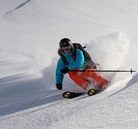


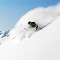


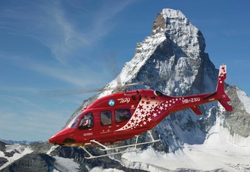
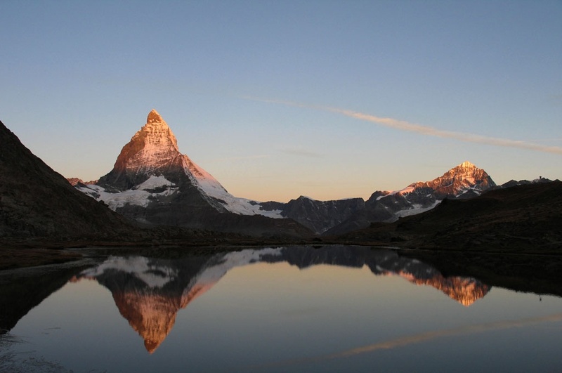
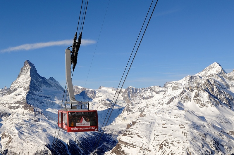
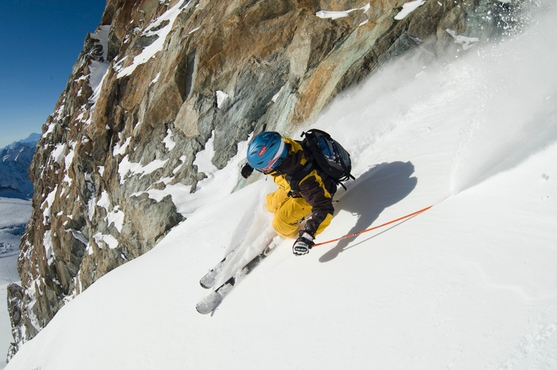
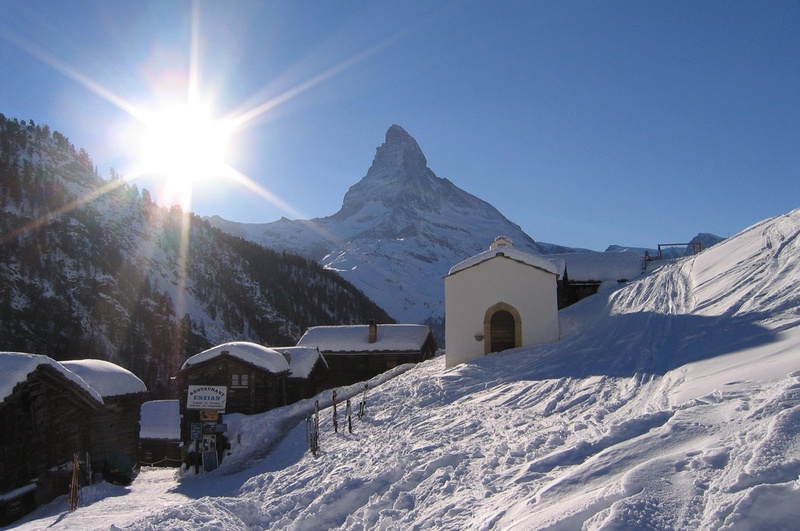
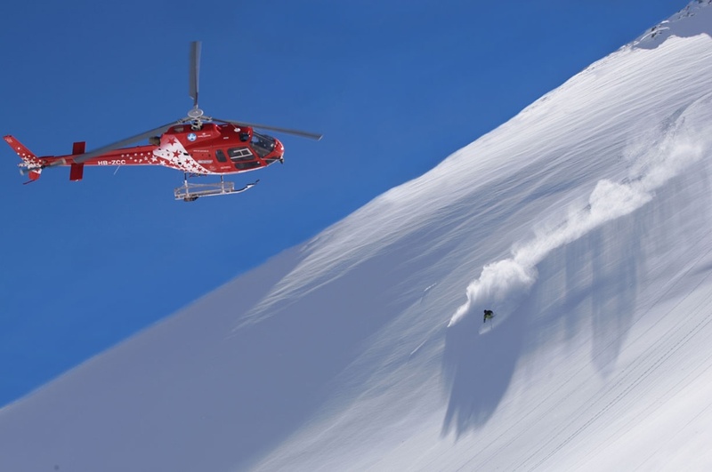
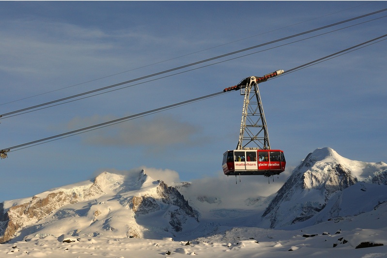
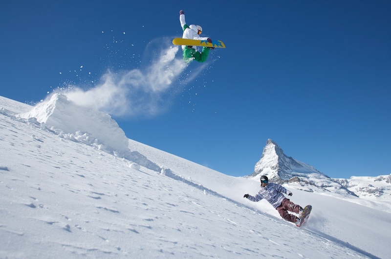
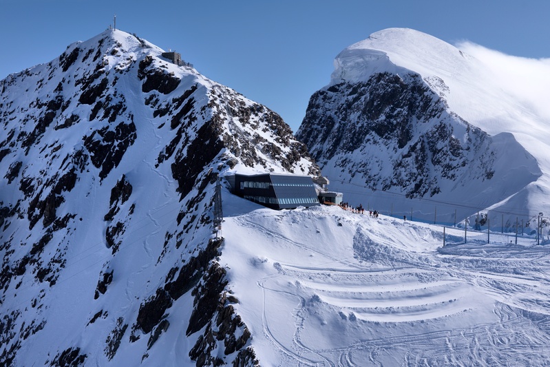
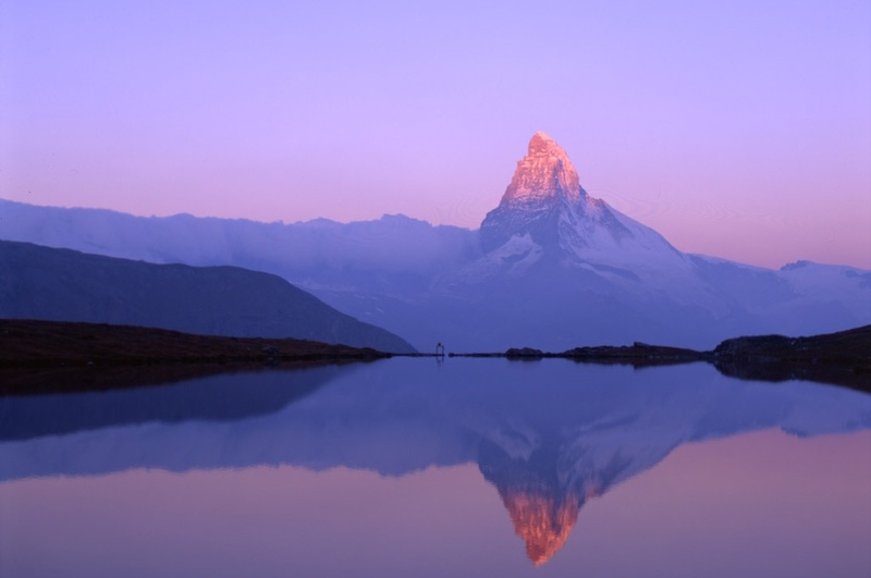
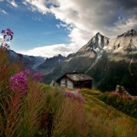


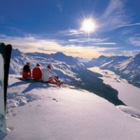
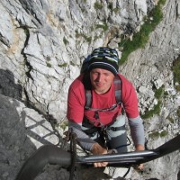
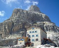


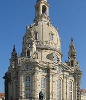

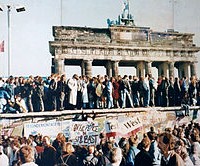
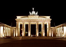
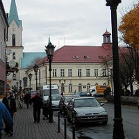

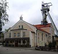


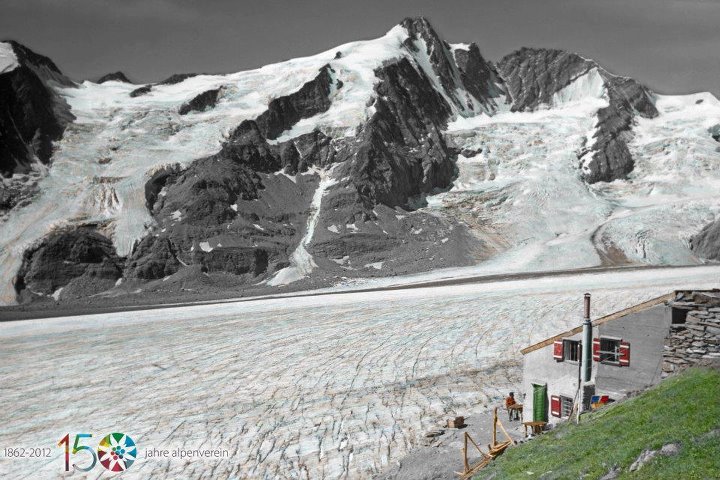
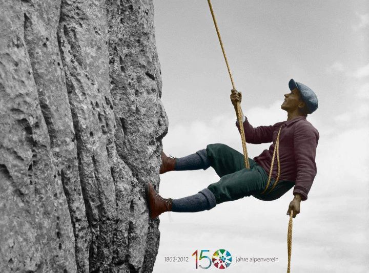
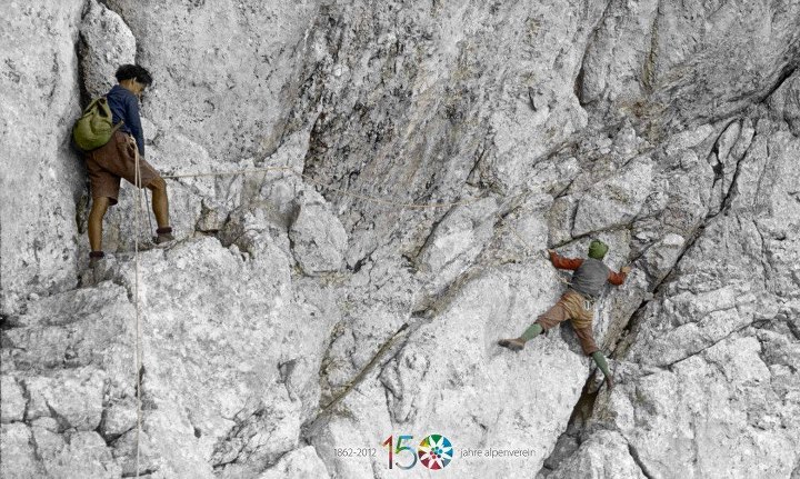


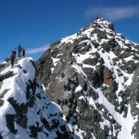
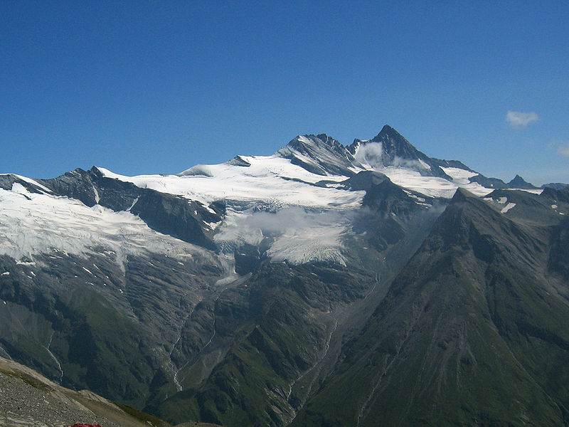
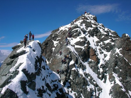
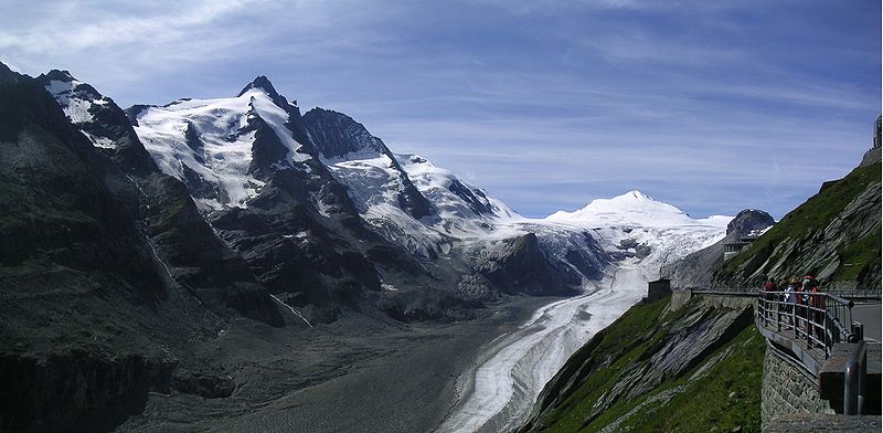


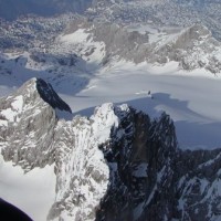


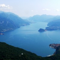

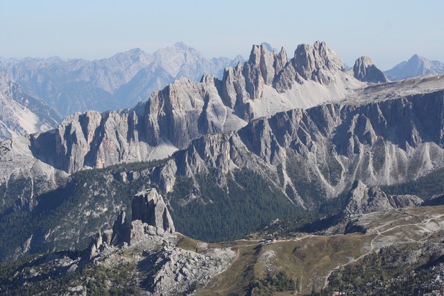

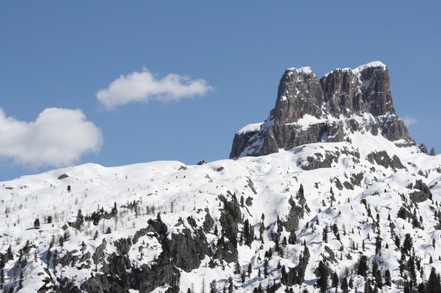

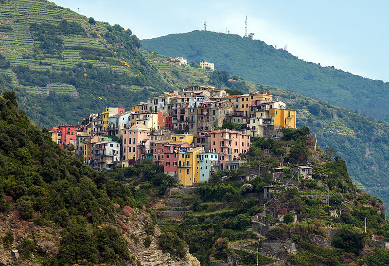
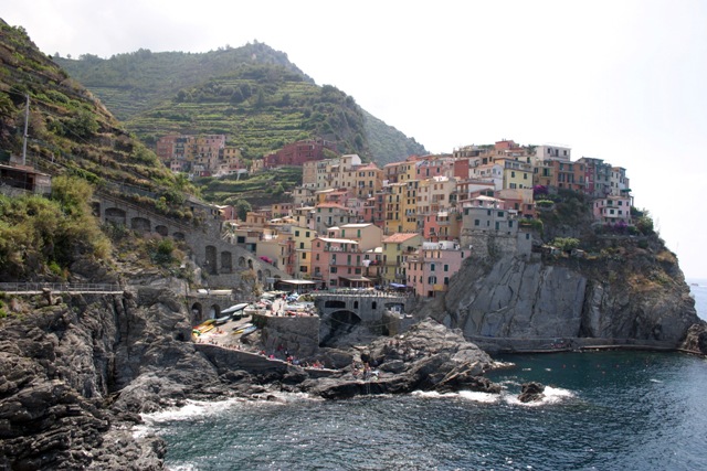
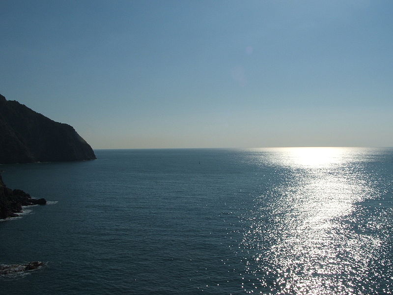
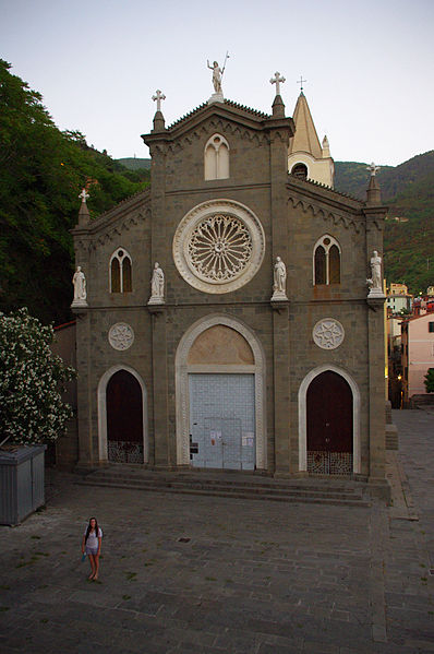

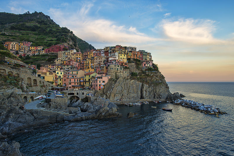
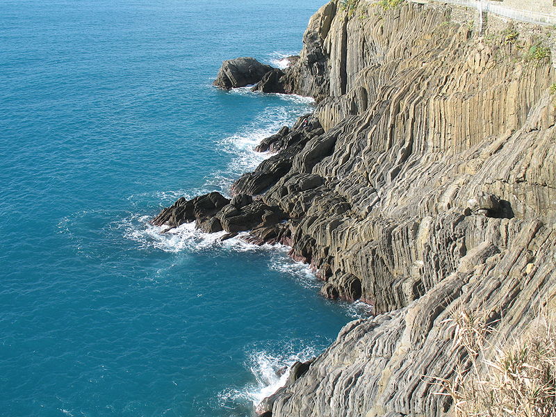

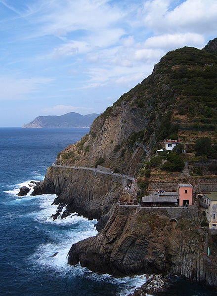
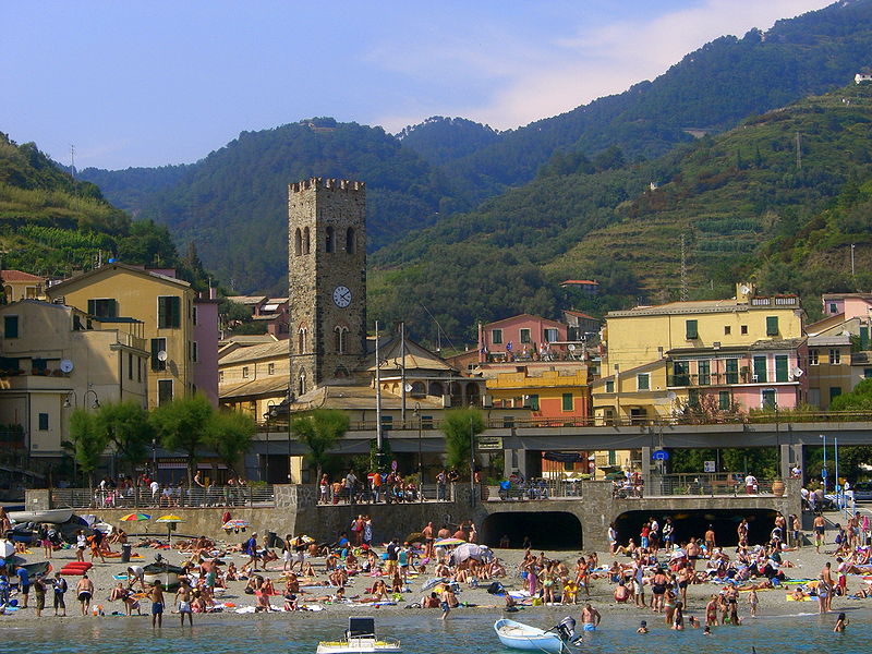

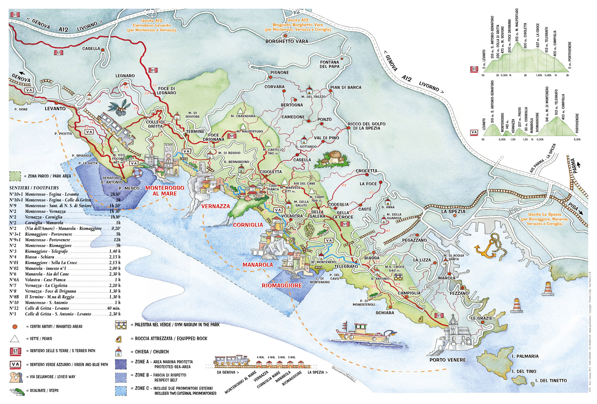


